
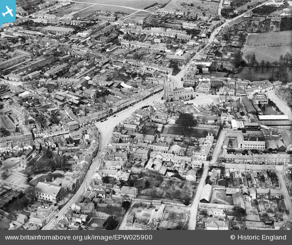
EPW025900 ENGLAND (1929). St Peter's Church and the town centre, Sudbury, 1929
© Copyright OpenStreetMap contributors and licensed by the OpenStreetMap Foundation. 2024. Cartography is licensed as CC BY-SA.
Nearby Images (18)
EPW025900

EAW042074

EPW025896

EPW001739

EAW029736

EAW029735

EPW001737

EPW025895

EAW042076

EAW042078

EAW042077

EAW042075

EAW042080

EAW042079

EAW042085

EAW042084

EAW042081

EAW042083

Details
| Title | [EPW025900] St Peter's Church and the town centre, Sudbury, 1929 |
| Reference | EPW025900 |
| Date | 3-April-1929 |
| Link | |
| Place name | SUDBURY |
| Parish | SUDBURY |
| District | |
| Country | ENGLAND |
| Easting / Northing | 587390, 241274 |
| Longitude / Latitude | 0.73243269854453, 52.037731055848 |
| National Grid Reference | TL874413 |
Pins
 paulinuk |
Tuesday 12th of January 2021 12:33:55 PM |


