
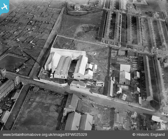
EPW025329 ENGLAND (1928). The Penpoll Tin Smelting Works, Bootle, 1928
© Copyright OpenStreetMap contributors and licensed by the OpenStreetMap Foundation. 2024. Cartography is licensed as CC BY-SA.
Nearby Images (17)
EPW025329

EPW025324

EPW025327

EPW025331

EPW025328

EPW025326

EPW025330

EPW025323

EPW055646

EPW025332

EPW055648

EPW055642

EPW055643

EPW055645

EPW055647

EPW055649

EPW055644

Details
| Title | [EPW025329] The Penpoll Tin Smelting Works, Bootle, 1928 |
| Reference | EPW025329 |
| Date | 3-November-1928 |
| Link | |
| Place name | BOOTLE |
| Parish | |
| District | |
| Country | ENGLAND |
| Easting / Northing | 334428, 396816 |
| Longitude / Latitude | -2.9878019331921, 53.463746572132 |
| National Grid Reference | SJ344968 |
Pins
 Lord Axminister |
Monday 15th of June 2015 01:31:19 AM | |
Ange |
Friday 31st of May 2013 10:26:32 PM | |
Ange |
Friday 31st of May 2013 10:25:45 PM |