
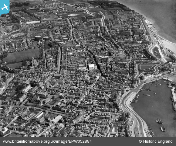
EPW052884 ENGLAND (1937). The town, Ramsgate, 1937. This image has been produced from a print.
© Copyright OpenStreetMap contributors and licensed by the OpenStreetMap Foundation. 2024. Cartography is licensed as CC BY-SA.
Nearby Images (8)
EPW052884

EPW018645

EPW052883

EPW018647

EPW000604

EPW000603

EPW018648

EPW048783

Details
| Title | [EPW052884] The town, Ramsgate, 1937. This image has been produced from a print. |
| Reference | EPW052884 |
| Date | 24-April-1937 |
| Link | |
| Place name | RAMSGATE |
| Parish | RAMSGATE |
| District | |
| Country | ENGLAND |
| Easting / Northing | 638317, 165032 |
| Longitude / Latitude | 1.4216809679944, 51.333845668643 |
| National Grid Reference | TR383650 |
Pins
Be the first to add a comment to this image!