
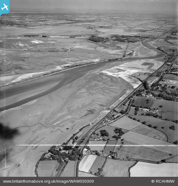
WAW030309 WALES (1950). View of dredging work for Shotton Steelworks commissioned by the Westminster Dredging Co. Ltd
© Copyright OpenStreetMap contributors and licensed by the OpenStreetMap Foundation. 2024. Cartography is licensed as CC BY-SA.
Nearby Images (48)
WAW024712
")
WAW024713
")
WAW024714
")
WAW024715
")
WAW024716
")
WAW024717
")
WAW024718
")
WAW024719
")
WAW024720
")
WAW024721
")
WAW024722
")
WAW027362
. Oblique aerial photograph, 5½\" cut roll film.")
WAW027366

WAW027367

WAW027370

WAW027382
. Oblique aerial photograph, 5½\" cut roll film.")
WAW027383
. Oblique aerial photograph, 5½\" cut roll film.")
WAW027384
. Oblique aerial photograph, 5½\" cut roll film.")
WAW030308

WAW030309

WAW030310

WAW030311

WAW030312

WAW030313

WAW030314

WAW030315

WAW030316
, for Shotton Steelworks commissioned by the Westminster Dredging Co. Ltd")
WAW030317
, for Shotton Steelworks commissioned by the Westminster Dredging Co. Ltd")
WAW030318
, for Shotton Steelworks commissioned by the Westminster Dredging Co. Ltd")
WAW030319

WAW030320

WAW030321

WAW030322

WAW030323

WAW030324

WAW030325

WAW030326

WAW030327

WAW030328

WAW030329

WAW030330

WAW030331

WAW030332

WAW030333
, for Shotton Steelworks commissioned by the Westminster Dredging Co. Ltd")
WAW030334

WAW030335

WAW030336

WAW030337

Details
| Title | [WAW030309] View of dredging work for Shotton Steelworks commissioned by the Westminster Dredging Co. Ltd |
| Reference | WAW030309 |
| Date | 1950 |
| Link | Coflein Archive Item 6414215 |
| Place name | |
| Parish | |
| District | |
| Country | WALES |
| Easting / Northing | 330500, 370500 |
| Longitude / Latitude | -3.0411853684416, 53.226709296404 |
| National Grid Reference | SJ305705 |
Pins
 redmist |
Tuesday 12th of September 2023 11:48:05 PM | |
redmist |
Friday 11th of October 2019 09:14:53 PM | |
redmist |
Friday 11th of October 2019 09:14:33 PM | |
redmist |
Friday 11th of October 2019 09:13:56 PM | |
redmist |
Friday 11th of October 2019 09:13:39 PM | |
redmist |
Friday 11th of October 2019 09:13:05 PM |
User Comment Contributions
This, and many other pictures in this "batch" are incorrectly assigned to "View of dredging work for Shotton Steelworks commissioned by the Westminster Dredging Co. Ltd". This is not correct, although obviously part of the same project, this picture and many others are of land reclamation works that were done for the Connahs Quay coal fired power station on the west side of the Dee Estuary- note - not the current gas fired one - ie in this this photo it is the light coloured area top right. |
e10694 |
Monday 10th of November 2014 06:27:05 PM |