
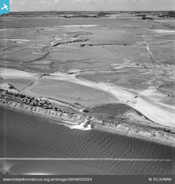
WAW030324 WALES (1950). View of dredging work for Shotton Steelworks commissioned by the Westminster Dredging Co. Ltd
© Copyright OpenStreetMap contributors and licensed by the OpenStreetMap Foundation. 2024. Cartography is licensed as CC BY-SA.
Nearby Images (48)
WAW024712
")
WAW024713
")
WAW024714
")
WAW024715
")
WAW024716
")
WAW024717
")
WAW024718
")
WAW024719
")
WAW024720
")
WAW024721
")
WAW024722
")
WAW027362
. Oblique aerial photograph, 5½\" cut roll film.")
WAW027366

WAW027367

WAW027370

WAW027382
. Oblique aerial photograph, 5½\" cut roll film.")
WAW027383
. Oblique aerial photograph, 5½\" cut roll film.")
WAW027384
. Oblique aerial photograph, 5½\" cut roll film.")
WAW030308

WAW030309

WAW030310

WAW030311

WAW030312

WAW030313

WAW030314

WAW030315

WAW030316
, for Shotton Steelworks commissioned by the Westminster Dredging Co. Ltd")
WAW030317
, for Shotton Steelworks commissioned by the Westminster Dredging Co. Ltd")
WAW030318
, for Shotton Steelworks commissioned by the Westminster Dredging Co. Ltd")
WAW030319

WAW030320

WAW030321

WAW030322

WAW030323

WAW030324

WAW030325

WAW030326

WAW030327

WAW030328

WAW030329

WAW030330

WAW030331

WAW030332

WAW030333
, for Shotton Steelworks commissioned by the Westminster Dredging Co. Ltd")
WAW030334

WAW030335

WAW030336

WAW030337

Details
| Title | [WAW030324] View of dredging work for Shotton Steelworks commissioned by the Westminster Dredging Co. Ltd |
| Reference | WAW030324 |
| Date | 1950 |
| Link | Coflein Archive Item 6414230 |
| Place name | |
| Parish | |
| District | |
| Country | WALES |
| Easting / Northing | 330500, 370500 |
| Longitude / Latitude | -3.0411853684416, 53.226709296404 |
| National Grid Reference | SJ305705 |
Pins
 redmist |
Thursday 14th of September 2023 08:06:01 PM | |
redmist |
Thursday 14th of September 2023 08:01:29 PM | |
redmist |
Saturday 12th of October 2019 10:32:47 AM |