
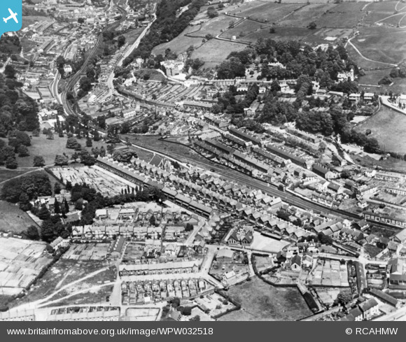
WPW032518 WALES (1930). General view of Pontypridd. Oblique aerial photograph, 5"x4" BW glass plate.
© Copyright OpenStreetMap contributors and licensed by the OpenStreetMap Foundation. 2024. Cartography is licensed as CC BY-SA.
Nearby Images (22)
WPW032420

WPW032421

WPW032422

WPW032490

WPW032491

WPW032492

WPW032493

WPW032494

WPW032495

WPW032496

WPW032518

WPW032525

WPW040013

WPW040014

WPW040015

WPW040016

WPW040017

WPW040018

WPW038318

WPW038319

WPW038320

WPW038321

Details
| Title | [WPW032518] General view of Pontypridd. Oblique aerial photograph, 5"x4" BW glass plate. |
| Reference | WPW032518 |
| Date | 1930 |
| Link | Coflein Archive Item 6422591 |
| Place name | |
| Parish | |
| District | |
| Country | WALES |
| Easting / Northing | 307270, 189900 |
| Longitude / Latitude | -3.339005185903, 51.599827197382 |
| National Grid Reference | ST073899 |
Pins
Be the first to add a comment to this image!
User Comment Contributions
Don't think this is Pontypridd - I can't fit it in anywhere and the housing just doesn't look right. |
 David Beilby |
Thursday 1st of January 2015 08:29:02 PM |
I agree. I think we should regard this photo as unidentified until we can get a definite identification of the location. |
 Class31 |
Thursday 1st of January 2015 08:29:02 PM |