
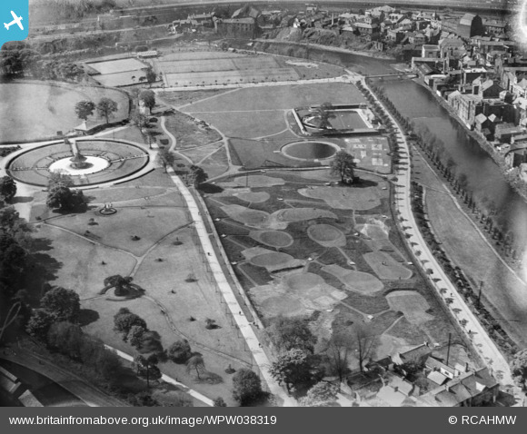
WPW038319 WALES (1932). View of Ynysangharad Park and swimming pool, oblique aerial view. 5"x4" black and white glass plate negative.
© Copyright OpenStreetMap contributors and licensed by the OpenStreetMap Foundation. 2024. Cartography is licensed as CC BY-SA.
Nearby Images (22)
WPW038318

WPW038319

WPW038320

WPW038321

WPW032420

WPW032421

WPW032422

WPW032490

WPW032491

WPW032492

WPW032493

WPW032494

WPW032495

WPW032496

WPW032518

WPW032525

WPW040013

WPW040014

WPW040015

WPW040016

WPW040017

WPW040018

Details
| Title | [WPW038319] View of Ynysangharad Park and swimming pool, oblique aerial view. 5"x4" black and white glass plate negative. |
| Reference | WPW038319 |
| Date | 1932 |
| Link | Coflein Archive Item 6370911 |
| Place name | |
| Parish | |
| District | |
| Country | WALES |
| Easting / Northing | 307463, 190125 |
| Longitude / Latitude | -3.3362784936884, 51.601881675881 |
| National Grid Reference | ST075901 |

