
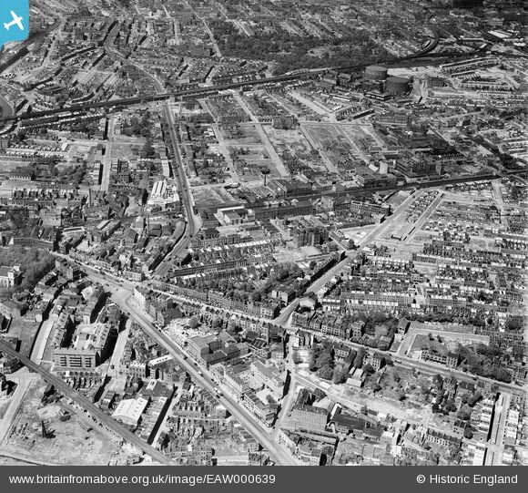
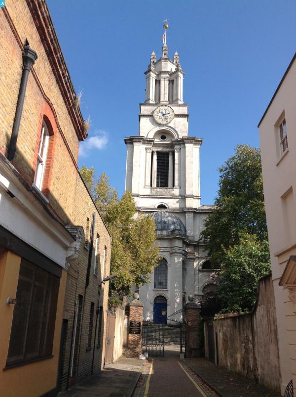
EAW000639 ENGLAND (1946). A cityscape over Limehouse and Bow Common, Poplar, 1946
© Copyright OpenStreetMap contributors and licensed by the OpenStreetMap Foundation. 2025. Cartography is licensed as CC BY-SA.
Nearby Images (9)
EAW000639

EAW035312

EAW035321

EAW035310

EPW045557

EAW035311

EAW035314

EAW000646

EAW000641

Details
| Title | [EAW000639] A cityscape over Limehouse and Bow Common, Poplar, 1946 |
| Reference | EAW000639 |
| Date | 10-May-1946 |
| Link | |
| Place name | POPLAR |
| Parish | |
| District | |
| Country | ENGLAND |
| Easting / Northing | 537039, 181251 |
| Longitude / Latitude | -0.024895162045196, 51.513059783348 |
| National Grid Reference | TQ370813 |
Pins
 DANNO2 |
Tuesday 29th of December 2020 03:08:42 PM | |
Dajode |
Tuesday 12th of May 2020 03:46:27 PM | |
Mo |
Friday 20th of September 2019 10:16:50 PM | |
Mo |
Friday 20th of September 2019 10:14:47 PM | |
Mo |
Friday 20th of September 2019 10:07:46 PM | |
Nowy Paul |
Saturday 13th of October 2018 11:13:19 AM | |
ray Glenister |
Thursday 20th of September 2018 06:51:38 AM | |
ray Glenister |
Thursday 20th of September 2018 06:43:34 AM | |
ray Glenister |
Thursday 20th of September 2018 06:41:12 AM | |
ray Glenister |
Thursday 20th of September 2018 06:38:34 AM | |
 |
ray Glenister |
Thursday 20th of September 2018 06:37:10 AM |
ray Glenister |
Thursday 20th of September 2018 06:19:32 AM | |
ray Glenister |
Friday 20th of October 2017 12:13:13 PM | |
Hermann the German |
Monday 28th of August 2017 05:33:26 PM | |
Hermann the German |
Monday 28th of August 2017 05:11:37 PM | |
Hermann the German |
Tuesday 15th of August 2017 07:57:52 PM | |
 |
ray Glenister |
Thursday 27th of July 2017 12:28:03 PM |
ray Glenister |
Thursday 27th of July 2017 12:16:19 PM | |
DEG |
Saturday 15th of July 2017 08:17:31 PM | |
DEG |
Saturday 15th of July 2017 08:15:35 PM | |
DEG |
Saturday 15th of July 2017 06:43:23 PM | |
DEG |
Saturday 15th of July 2017 06:32:44 PM | |
DEG |
Saturday 15th of July 2017 06:10:41 PM | |
DEG |
Saturday 15th of July 2017 06:10:09 PM | |
DEG |
Saturday 15th of July 2017 06:03:32 PM | |
DEG |
Saturday 24th of June 2017 06:50:25 PM | |
 |
ray Glenister |
Saturday 25th of February 2017 08:04:02 AM |
ray Glenister |
Saturday 25th of February 2017 07:14:32 AM | |
 |
ray Glenister |
Saturday 25th of February 2017 01:36:59 AM |
ray Glenister |
Friday 24th of February 2017 02:40:10 PM | |
ray Glenister |
Friday 24th of February 2017 02:20:59 PM | |
ray Glenister |
Friday 24th of February 2017 02:15:13 PM | |
ray Glenister |
Friday 24th of February 2017 02:09:40 PM | |
ray Glenister |
Friday 24th of February 2017 02:08:20 PM | |
ray Glenister |
Friday 24th of February 2017 02:06:32 PM | |
ray Glenister |
Friday 24th of February 2017 02:04:13 PM | |
ray Glenister |
Friday 24th of February 2017 02:02:41 PM | |
ray Glenister |
Friday 24th of February 2017 01:59:22 PM | |
ray Glenister |
Friday 24th of February 2017 01:56:09 PM | |
 Class31 |
Tuesday 1st of September 2015 08:10:52 AM | |
Class31 |
Tuesday 1st of September 2015 08:09:34 AM | |
Ian |
Monday 5th of January 2015 09:10:50 PM | |
.jpg) Dominic Sayers |
Friday 28th of November 2014 05:18:29 PM | |
Not seen the site you refer to but a lot of incendiary devices were dropped. Relatively small they would crash through the roofs of buildings and set the inside ablaze. You will see what appear to be many intact but burnt out houses on this site. |
Grollo |
Tuesday 1st of September 2015 01:06:09 AM |
Ian |
Saturday 18th of January 2014 08:42:12 PM | |
Ian |
Saturday 18th of January 2014 08:39:30 PM | |
Ian |
Saturday 18th of January 2014 08:37:51 PM | |
Ian |
Saturday 18th of January 2014 08:18:44 PM | |
Ian |
Saturday 18th of January 2014 08:18:05 PM | |
Hermann the German |
Saturday 12th of October 2013 03:27:53 PM | |
Hermann the German |
Saturday 12th of October 2013 03:20:10 PM |

User Comment Contributions
This picture clearly shows massive demolition beyond Agnes Street and Clemence Street between Burdett Road and Locksley Street. Yet the bomb data shows no bomb north of Pixley Street or east of Dora Street. Bomb Sight data again: http://bombsight.org/bombs/29651/ I'd be surprised if destruction on this scale was the result of incendiary devices. |
Dominic Sayers |
Friday 24th of February 2017 01:52:39 PM |
Hi Dominic. As a kid I played on the bomb sites between Locksley and Burdett. "BOMB SITE' shows where bombs fell between 7/10/1940 and 6/6/41. The Blitz began on September 7, 1940 with the bombing of East London. So you are correct. Bombs did fall on that area that are not shown on the Bomb Site map. There were degrees of damage to houses. From destroyed to bomb blasted such as those of Burdett Road that were finally demolished in the early 1950's. Check out 'Collage London Photo Archive' for superb photos of that area in the 50's including Pixley Street. Key in Locksley Street or Turners. All the best Ray. |
ray Glenister |
Friday 24th of February 2017 01:52:39 PM |