
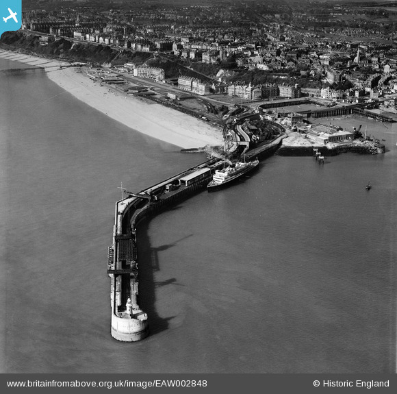
EAW002848 ENGLAND (1946). Folkestone Harbour Pier, Folkestone, 1946
© Copyright OpenStreetMap contributors and licensed by the OpenStreetMap Foundation. 2025. Cartography is licensed as CC BY-SA.
Nearby Images (8)
EAW002848

EAW002850

EAW002849

EPW042866

EPW000089

EAW002379

EPW042865

EAW317182

Details
| Title | [EAW002848] Folkestone Harbour Pier, Folkestone, 1946 |
| Reference | EAW002848 |
| Date | 1-October-1946 |
| Link | |
| Place name | FOLKESTONE |
| Parish | FOLKESTONE |
| District | |
| Country | ENGLAND |
| Easting / Northing | 623644, 135677 |
| Longitude / Latitude | 1.1930795143412, 51.076230645454 |
| National Grid Reference | TR236357 |
Pins
 redmist |
Sunday 16th of February 2025 09:31:03 AM | |
redmist |
Sunday 16th of February 2025 09:24:00 AM | |
Sara |
Friday 9th of July 2021 09:50:24 PM | |
Sara |
Friday 9th of July 2021 09:49:02 PM |
User Comment Contributions
This is either the "Prince Baudouin" or the "Prins Albert",Belgian Marine vessel of Ostend. |
Martyn |
Monday 14th of July 2014 11:22:01 PM |