
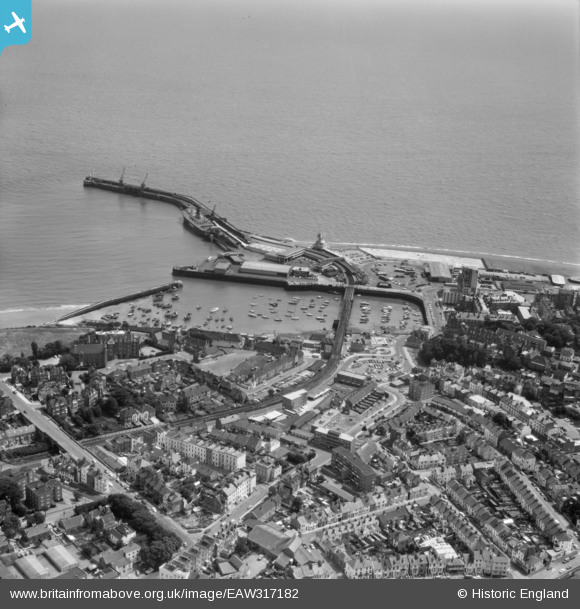
EAW317182 ENGLAND (1976). Town and harbour, Folkestone, 1976
© Copyright OpenStreetMap contributors and licensed by the OpenStreetMap Foundation. 2025. Cartography is licensed as CC BY-SA.
Nearby Images (13)
EAW317182

EAW024826

EAW006157

EPW042865

EPW000372

EPW019065

EPW000149

EAW002853

EPW035410

EAW002849

EAW002850

EAW002378

EAW002848

Details
| Title | [EAW317182] Town and harbour, Folkestone, 1976 |
| Reference | EAW317182 |
| Date | 10-June-1976 |
| Link | |
| Place name | FOLKESTONE |
| Parish | FOLKESTONE |
| District | |
| Country | ENGLAND |
| Easting / Northing | 623396, 135892 |
| Longitude / Latitude | 1.1896774374704, 51.078257771423 |
| National Grid Reference | TR234359 |
Pins
 Sara |
Wednesday 24th of January 2024 07:08:02 PM | |
Sara |
Wednesday 24th of January 2024 07:07:39 PM | |
Sara |
Wednesday 24th of January 2024 07:05:59 PM |