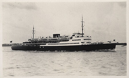
EAW002849 ENGLAND (1946). An unidentified ship moored at Folkestone Harbour Pier, Folkestone, 1946

© Copyright OpenStreetMap contributors and licensed by the OpenStreetMap Foundation. 2025. Cartography is licensed as CC BY-SA.
Nearby Images (8)
EAW002849

EAW002850

EAW002848

EPW042866

EPW042865

EAW024826

EAW006157

EAW317182

Details
| Title | [EAW002849] An unidentified ship moored at Folkestone Harbour Pier, Folkestone, 1946 |
| Reference | EAW002849 |
| Date | 1-October-1946 |
| Link | |
| Place name | FOLKESTONE |
| Parish | FOLKESTONE |
| District | |
| Country | ENGLAND |
| Easting / Northing | 623616, 135703 |
| Longitude / Latitude | 1.1926964913526, 51.07647501558 |
| National Grid Reference | TR236357 |
Pins
 mannidaze |
Thursday 24th of January 2019 05:19:08 PM | |
Sparky |
Saturday 16th of September 2017 12:00:15 PM | |
mannidaze |
Wednesday 5th of November 2014 12:50:48 PM |