
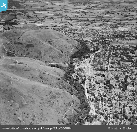
EAW006884 ENGLAND (1947). The northern end of the Malvern Hills and the town, Great Malvern, 1947
© Copyright OpenStreetMap contributors and licensed by the OpenStreetMap Foundation. 2025. Cartography is licensed as CC BY-SA.
Nearby Images (7)
EAW006884

EPW061946

EPW041843

EAW006883

EPW061950

EPW033920

EPW041840

Details
| Title | [EAW006884] The northern end of the Malvern Hills and the town, Great Malvern, 1947 |
| Reference | EAW006884 |
| Date | 10-June-1947 |
| Link | |
| Place name | GREAT MALVERN |
| Parish | MALVERN |
| District | |
| Country | ENGLAND |
| Easting / Northing | 377303, 246039 |
| Longitude / Latitude | -2.3314750639015, 52.111797318602 |
| National Grid Reference | SO773460 |
Pins
 Judy B |
Wednesday 8th of July 2020 10:22:37 AM | |
MikeS |
Friday 19th of December 2014 09:26:41 PM | |
MikeS |
Friday 19th of December 2014 08:51:29 PM | |
Don Knight |
Tuesday 3rd of December 2013 01:00:02 PM | |
Don Knight |
Tuesday 3rd of December 2013 12:58:49 PM | |
Cowshed |
Friday 15th of November 2013 09:54:40 PM | |
Cowshed |
Friday 15th of November 2013 09:54:12 PM |