
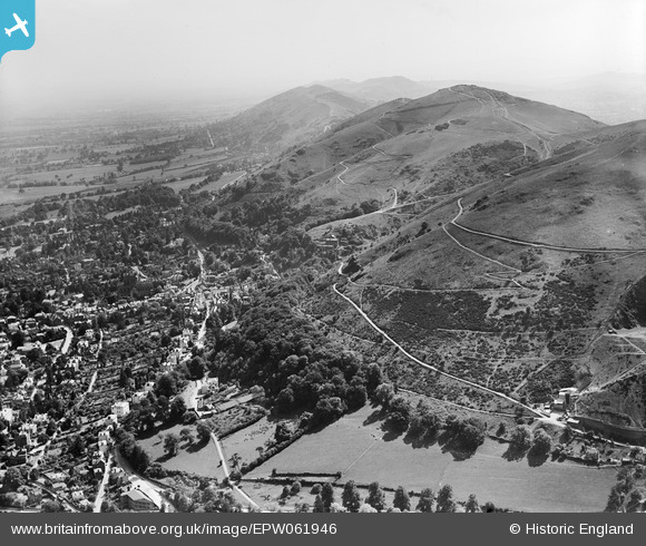
EPW061946 ENGLAND (1939). The Malvern Hills, Great Malvern, 1939
© Copyright OpenStreetMap contributors and licensed by the OpenStreetMap Foundation. 2025. Cartography is licensed as CC BY-SA.
Nearby Images (7)
EPW061946

EAW006884

EPW041843

EPW061950

EAW006883

EPW033920

EPW041840

Details
| Title | [EPW061946] The Malvern Hills, Great Malvern, 1939 |
| Reference | EPW061946 |
| Date | 8-June-1939 |
| Link | |
| Place name | GREAT MALVERN |
| Parish | MALVERN |
| District | |
| Country | ENGLAND |
| Easting / Northing | 377268, 246051 |
| Longitude / Latitude | -2.3319870084788, 52.111903777628 |
| National Grid Reference | SO773461 |

