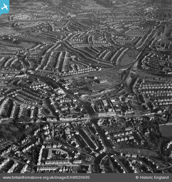
EAW020695 ENGLAND (1948). Central Edgware, Edgware, 1948
© Copyright OpenStreetMap contributors and licensed by the OpenStreetMap Foundation. 2025. Cartography is licensed as CC BY-SA.
Nearby Images (32)
Details
| Title | [EAW020695] Central Edgware, Edgware, 1948 |
| Reference | EAW020695 |
| Date | 17-December-1948 |
| Link | |
| Place name | EDGWARE |
| Parish | |
| District | |
| Country | ENGLAND |
| Easting / Northing | 519508, 191794 |
| Longitude / Latitude | -0.27384720377417, 51.611805047705 |
| National Grid Reference | TQ195918 |
Pins
 NobodyInteresting |
Sunday 7th of April 2024 02:29:58 AM | |
 Class31 |
Wednesday 30th of April 2014 09:38:23 AM | |
 NthLondonBoy |
Sunday 22nd of December 2013 08:05:32 PM | |
 NthLondonBoy |
Sunday 22nd of December 2013 08:04:05 PM | |
 NthLondonBoy |
Sunday 22nd of December 2013 08:03:20 PM | |
 NthLondonBoy |
Sunday 22nd of December 2013 08:01:46 PM | |
The story goes that the Ritz was built on marshy ground. Consequently, for the first couple of years the organ pit would flood, the water draining off as it was raised up. |
 colsouth111 |
Wednesday 29th of January 2014 02:34:32 PM |
User Comment Contributions
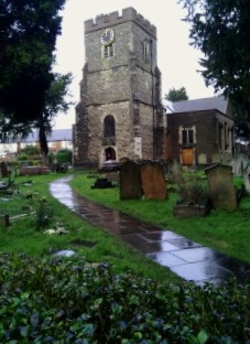
 The Parish Church of St. Margaret of Antioch 18/02/2014 |
 Class31 |
Friday 21st of February 2014 12:30:35 PM |


![[EAW020695] Central Edgware, Edgware, 1948](http://britainfromabove.org.uk/sites/all/libraries/aerofilms-images/public/100x100/EAW/020/EAW020695.jpg)
![[EPW034554] The railway and underground stations and environs, Edgware, from the south-east, 1930](http://britainfromabove.org.uk/sites/all/libraries/aerofilms-images/public/100x100/EPW/034/EPW034554.jpg)
![[EPW031556] Edgware Railway Station and surroundings, Edgware, from the north-west, 1930](http://britainfromabove.org.uk/sites/all/libraries/aerofilms-images/public/100x100/EPW/031/EPW031556.jpg)
![[EPW009603] Station Road and environs, Edgware, 1923](http://britainfromabove.org.uk/sites/all/libraries/aerofilms-images/public/100x100/EPW/009/EPW009603.jpg)
![[EPW009341] Construction of the underground station, Edgware, 1923](http://britainfromabove.org.uk/sites/all/libraries/aerofilms-images/public/100x100/EPW/009/EPW009341.jpg)
![[EPW034614] A new housing estate under construction near Lower Hale, Edgware, from the south-west, 1930](http://britainfromabove.org.uk/sites/all/libraries/aerofilms-images/public/100x100/EPW/034/EPW034614.jpg)
![[EPW009342] Construction of the underground station, Edgware, 1923](http://britainfromabove.org.uk/sites/all/libraries/aerofilms-images/public/100x100/EPW/009/EPW009342.jpg)
![[EPW015982] Edgware Railway Station, Edgware, 1926. This image has been produced from a copy-negative.](http://britainfromabove.org.uk/sites/all/libraries/aerofilms-images/public/100x100/EPW/015/EPW015982.jpg)
![[EPW016514] The underground station and bus depot, Edgware, 1926](http://britainfromabove.org.uk/sites/all/libraries/aerofilms-images/public/100x100/EPW/016/EPW016514.jpg)
![[EPW031551] Edgware London Electric Railway Station and surroundings, Edgware, from the south-west, 1930](http://britainfromabove.org.uk/sites/all/libraries/aerofilms-images/public/100x100/EPW/031/EPW031551.jpg)
![[EPW009343] Construction of the underground station, Edgware, 1923](http://britainfromabove.org.uk/sites/all/libraries/aerofilms-images/public/100x100/EPW/009/EPW009343.jpg)
![[EPW016516] The underground station, bus depot and environs, Edgware, 1926](http://britainfromabove.org.uk/sites/all/libraries/aerofilms-images/public/100x100/EPW/016/EPW016516.jpg)
![[EAW048861] Edgware Tube Station and the surrounding residential area, Edgware, 1953](http://britainfromabove.org.uk/sites/all/libraries/aerofilms-images/public/100x100/EAW/048/EAW048861.jpg)
![[EPW009374] Construction of underground station, Edgware, 1923](http://britainfromabove.org.uk/sites/all/libraries/aerofilms-images/public/100x100/EPW/009/EPW009374.jpg)
![[EPW015770] Edgware underground station, Edgware, 1926](http://britainfromabove.org.uk/sites/all/libraries/aerofilms-images/public/100x100/EPW/015/EPW015770.jpg)
![[EPW009376] Construction of underground station, Edgware, 1923](http://britainfromabove.org.uk/sites/all/libraries/aerofilms-images/public/100x100/EPW/009/EPW009376.jpg)
![[EPW034613] A new housing estate under construction near Lower Hale, Edgware, from the south-west, 1930](http://britainfromabove.org.uk/sites/all/libraries/aerofilms-images/public/100x100/EPW/034/EPW034613.jpg)
![[EPW005282] Wright and Sons Tool Works at Thorn Bank, Edgware, 1921](http://britainfromabove.org.uk/sites/all/libraries/aerofilms-images/public/100x100/EPW/005/EPW005282.jpg)
![[EPW034620] Housing development around Green Lane and the railway stations, Edgware, from the south-east, 1930](http://britainfromabove.org.uk/sites/all/libraries/aerofilms-images/public/100x100/EPW/034/EPW034620.jpg)
![[EPW031554] Edgware London Electric Railway Station, Station Road and surroundings, Edgware, 1930](http://britainfromabove.org.uk/sites/all/libraries/aerofilms-images/public/100x100/EPW/031/EPW031554.jpg)
![[EPW031553] Edgware London Electric Railway Station, Station Road and surroundings, Edgware, from the south, 1930](http://britainfromabove.org.uk/sites/all/libraries/aerofilms-images/public/100x100/EPW/031/EPW031553.jpg)
![[EPW016513] The underground station and bus depot, Edgware, 1926](http://britainfromabove.org.uk/sites/all/libraries/aerofilms-images/public/100x100/EPW/016/EPW016513.jpg)
![[EPW034615] A new housing estate under construction near Lower Hale, Edgware, from the south-west, 1930](http://britainfromabove.org.uk/sites/all/libraries/aerofilms-images/public/100x100/EPW/034/EPW034615.jpg)
![[EPW005277] Wright and Sons Tool Works at Thorn Bank, Edgware, 1921](http://britainfromabove.org.uk/sites/all/libraries/aerofilms-images/public/100x100/EPW/005/EPW005277.jpg)
![[EPW009373] Construction of underground station, Edgware, 1923](http://britainfromabove.org.uk/sites/all/libraries/aerofilms-images/public/100x100/EPW/009/EPW009373.jpg)
![[EPW034618] Housing development around Green Lane and the railway stations, Edgware, from the south-east, 1930](http://britainfromabove.org.uk/sites/all/libraries/aerofilms-images/public/100x100/EPW/034/EPW034618.jpg)
![[EPW005281] Wright and Sons Tool Works at Thorn Bank, Edgware, 1921](http://britainfromabove.org.uk/sites/all/libraries/aerofilms-images/public/100x100/EPW/005/EPW005281.jpg)
![[EPW034610] A new housing estate under construction near Lower Hale, Edgware, from the south-west, 1930](http://britainfromabove.org.uk/sites/all/libraries/aerofilms-images/public/100x100/EPW/034/EPW034610.jpg)
![[EAW020694] Central Edgware and the view towards Stanmore, Edgware, from the south-east, 1948](http://britainfromabove.org.uk/sites/all/libraries/aerofilms-images/public/100x100/EAW/020/EAW020694.jpg)
![[EPW016512] The railway station and environs, Edgware, 1926](http://britainfromabove.org.uk/sites/all/libraries/aerofilms-images/public/100x100/EPW/016/EPW016512.jpg)
![[EPW034612] Housing development around the railway stations, Edgware, from the west, 1930](http://britainfromabove.org.uk/sites/all/libraries/aerofilms-images/public/100x100/EPW/034/EPW034612.jpg)
![[EAW020693] Edgware and the view towards Borehamwood, Edgware, from the south, 1948](http://britainfromabove.org.uk/sites/all/libraries/aerofilms-images/public/100x100/EAW/020/EAW020693.jpg)