
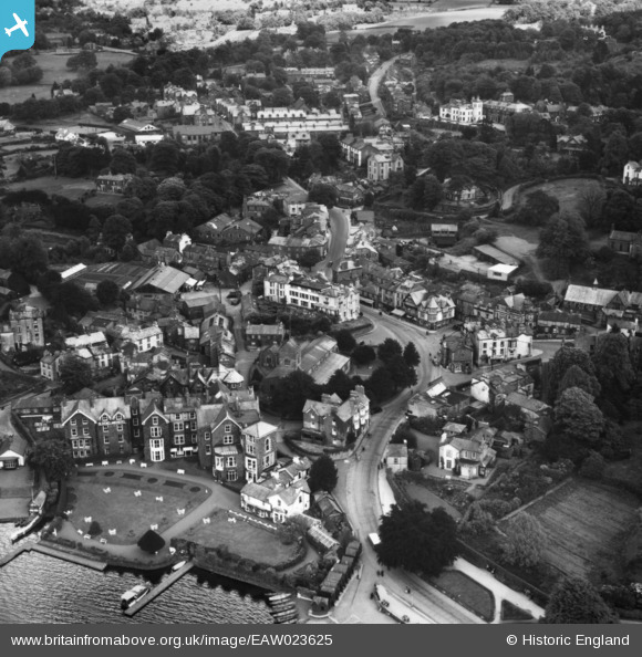
EAW023625 ENGLAND (1949). The town, Bowness-On-Windermere, 1949. This image has been produced from a print.
© Copyright OpenStreetMap contributors and licensed by the OpenStreetMap Foundation. 2025. Cartography is licensed as CC BY-SA.
Nearby Images (12)
EAW023625

EPW026769

EPW026740

EPW026741

EPW026772

EPW004033

EPW025637

EAW025637

EPW026773

EPW004032

EAW025636

EPW004041

Details
| Title | [EAW023625] The town, Bowness-On-Windermere, 1949. This image has been produced from a print. |
| Reference | EAW023625 |
| Date | 2-June-1949 |
| Link | |
| Place name | BOWNESS-ON-WINDERMERE |
| Parish | WINDERMERE |
| District | |
| Country | ENGLAND |
| Easting / Northing | 340295, 496925 |
| Longitude / Latitude | -2.9189782702118, 54.36419475854 |
| National Grid Reference | SD403969 |
Pins
Be the first to add a comment to this image!