
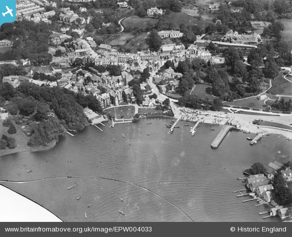
EPW004033 ENGLAND (1920). Bowness Bay, Bowness on Windermere, 1920
© Copyright OpenStreetMap contributors and licensed by the OpenStreetMap Foundation. 2025. Cartography is licensed as CC BY-SA.
Nearby Images (15)
EPW004033

EPW025637

EAW025637

EPW026773

EPW026772

EPW026740

EPW004032

EAW025636

EAW023625

EAW026244

EPW026741

EPW026769

EPW026737

EPW004041

EPW004037

Details
| Title | [EPW004033] Bowness Bay, Bowness on Windermere, 1920 |
| Reference | EPW004033 |
| Date | August-1920 |
| Link | |
| Place name | BOWNESS ON WINDERMERE |
| Parish | WINDERMERE |
| District | |
| Country | ENGLAND |
| Easting / Northing | 340166, 496864 |
| Longitude / Latitude | -2.9209512872373, 54.36363142118 |
| National Grid Reference | SD402969 |

