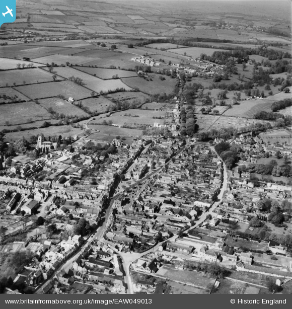
EAW049013 ENGLAND (1953). The town, Chipping Norton, 1953
© Copyright OpenStreetMap contributors and licensed by the OpenStreetMap Foundation. 2025. Cartography is licensed as CC BY-SA.
Nearby Images (9)
Details
| Title | [EAW049013] The town, Chipping Norton, 1953 |
| Reference | EAW049013 |
| Date | 5-May-1953 |
| Link | |
| Place name | CHIPPING NORTON |
| Parish | CHIPPING NORTON |
| District | |
| Country | ENGLAND |
| Easting / Northing | 431379, 227360 |
| Longitude / Latitude | -1.5434472222264, 51.943422142596 |
| National Grid Reference | SP314274 |
Pins
Be the first to add a comment to this image!


![[EAW049013] The town, Chipping Norton, 1953](http://britainfromabove.org.uk/sites/all/libraries/aerofilms-images/public/100x100/EAW/049/EAW049013.jpg)
![[EPW026910] Spring Street and environs, Chipping Norton, 1929](http://britainfromabove.org.uk/sites/all/libraries/aerofilms-images/public/100x100/EPW/026/EPW026910.jpg)
![[EAW049012] The northern part of the town, Chipping Norton, 1953](http://britainfromabove.org.uk/sites/all/libraries/aerofilms-images/public/100x100/EAW/049/EAW049012.jpg)
![[EPW026913] The town centre, Chipping Norton, 1929](http://britainfromabove.org.uk/sites/all/libraries/aerofilms-images/public/100x100/EPW/026/EPW026913.jpg)
![[EAW049014] The town centre, Chipping Norton, 1953. This image was marked by Aerofilms Ltd for photo editing.](http://britainfromabove.org.uk/sites/all/libraries/aerofilms-images/public/100x100/EAW/049/EAW049014.jpg)
![[EAW049010] The town centre, Chipping Norton, 1953](http://britainfromabove.org.uk/sites/all/libraries/aerofilms-images/public/100x100/EAW/049/EAW049010.jpg)
![[EPW026911] The Market Place, Chipping Norton, 1929](http://britainfromabove.org.uk/sites/all/libraries/aerofilms-images/public/100x100/EPW/026/EPW026911.jpg)
![[EPW026914] St Mary's Church and Chipping Norton Castle, Chipping Norton, 1929](http://britainfromabove.org.uk/sites/all/libraries/aerofilms-images/public/100x100/EPW/026/EPW026914.jpg)
![[EPW026905] The Market Place, Chipping Norton, 1929](http://britainfromabove.org.uk/sites/all/libraries/aerofilms-images/public/100x100/EPW/026/EPW026905.jpg)