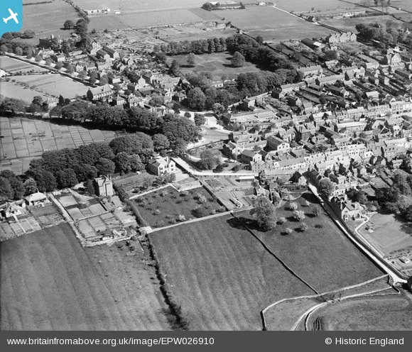
EPW026910 ENGLAND (1929). Spring Street and environs, Chipping Norton, 1929
© Copyright OpenStreetMap contributors and licensed by the OpenStreetMap Foundation. 2025. Cartography is licensed as CC BY-SA.
Nearby Images (6)
Details
| Title | [EPW026910] Spring Street and environs, Chipping Norton, 1929 |
| Reference | EPW026910 |
| Date | May-1929 |
| Link | |
| Place name | CHIPPING NORTON |
| Parish | CHIPPING NORTON |
| District | |
| Country | ENGLAND |
| Easting / Northing | 431423, 227410 |
| Longitude / Latitude | -1.5428024897685, 51.943869235523 |
| National Grid Reference | SP314274 |


![[EPW026910] Spring Street and environs, Chipping Norton, 1929](http://britainfromabove.org.uk/sites/all/libraries/aerofilms-images/public/100x100/EPW/026/EPW026910.jpg)
![[EAW049013] The town, Chipping Norton, 1953](http://britainfromabove.org.uk/sites/all/libraries/aerofilms-images/public/100x100/EAW/049/EAW049013.jpg)
![[EAW049012] The northern part of the town, Chipping Norton, 1953](http://britainfromabove.org.uk/sites/all/libraries/aerofilms-images/public/100x100/EAW/049/EAW049012.jpg)
![[EPW026913] The town centre, Chipping Norton, 1929](http://britainfromabove.org.uk/sites/all/libraries/aerofilms-images/public/100x100/EPW/026/EPW026913.jpg)
![[EAW049014] The town centre, Chipping Norton, 1953. This image was marked by Aerofilms Ltd for photo editing.](http://britainfromabove.org.uk/sites/all/libraries/aerofilms-images/public/100x100/EAW/049/EAW049014.jpg)
![[EAW049010] The town centre, Chipping Norton, 1953](http://britainfromabove.org.uk/sites/all/libraries/aerofilms-images/public/100x100/EAW/049/EAW049010.jpg)
