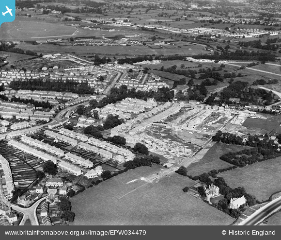
EPW034479 ENGLAND (1930). Housing under construction at Springfield Mount and environs, Kingsbury, 1930
© Copyright OpenStreetMap contributors and licensed by the OpenStreetMap Foundation. 2025. Cartography is licensed as CC BY-SA.
Nearby Images (8)
Details
| Title | [EPW034479] Housing under construction at Springfield Mount and environs, Kingsbury, 1930 |
| Reference | EPW034479 |
| Date | August-1930 |
| Link | |
| Place name | KINGSBURY |
| Parish | |
| District | |
| Country | ENGLAND |
| Easting / Northing | 521101, 188919 |
| Longitude / Latitude | -0.25184238624607, 51.585623607193 |
| National Grid Reference | TQ211889 |
Pins
Be the first to add a comment to this image!


![[EPW034479] Housing under construction at Springfield Mount and environs, Kingsbury, 1930](http://britainfromabove.org.uk/sites/all/libraries/aerofilms-images/public/100x100/EPW/034/EPW034479.jpg)
![[EPW034481] Housing under construction at Springfield Mount and environs, Kingsbury, 1930](http://britainfromabove.org.uk/sites/all/libraries/aerofilms-images/public/100x100/EPW/034/EPW034481.jpg)
![[EPW034483] Housing under construction at Springfield Mount and environs, Kingsbury, 1930](http://britainfromabove.org.uk/sites/all/libraries/aerofilms-images/public/100x100/EPW/034/EPW034483.jpg)
![[EPW034482] Housing under construction at Springfield Mount and environs, Kingsbury, 1930](http://britainfromabove.org.uk/sites/all/libraries/aerofilms-images/public/100x100/EPW/034/EPW034482.jpg)
![[EPW034473] Housing under construction at Derwent Avenue and environs, Kingsbury, 1930](http://britainfromabove.org.uk/sites/all/libraries/aerofilms-images/public/100x100/EPW/034/EPW034473.jpg)
![[EPW034476] Housing under construction at Springfield Mount and environs, Kingsbury, 1930](http://britainfromabove.org.uk/sites/all/libraries/aerofilms-images/public/100x100/EPW/034/EPW034476.jpg)
![[EPW034480] Housing under construction at Springfield Mount and environs, Kingsbury, 1930](http://britainfromabove.org.uk/sites/all/libraries/aerofilms-images/public/100x100/EPW/034/EPW034480.jpg)
![[EPW034477] Housing under construction at Springfield Mount and environs, Kingsbury, 1930](http://britainfromabove.org.uk/sites/all/libraries/aerofilms-images/public/100x100/EPW/034/EPW034477.jpg)