
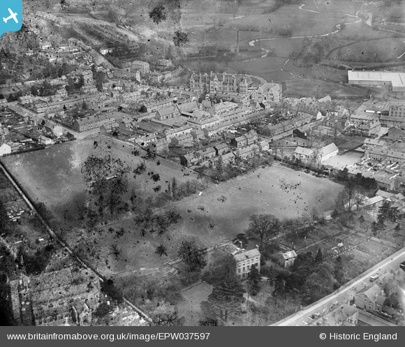
EPW037597 ENGLAND (1932). St John's Street and environs, Kidderminster, 1932. This image has been produced from a damaged negative.
© Copyright OpenStreetMap contributors and licensed by the OpenStreetMap Foundation. 2025. Cartography is licensed as CC BY-SA.
Nearby Images (4)
EPW037597

EPW037595

EPW034231

EPW037596

Details
| Title | [EPW037597] St John's Street and environs, Kidderminster, 1932. This image has been produced from a damaged negative. |
| Reference | EPW037597 |
| Date | April-1932 |
| Link | |
| Place name | KIDDERMINSTER |
| Parish | |
| District | |
| Country | ENGLAND |
| Easting / Northing | 382429, 276773 |
| Longitude / Latitude | -2.2582134929676, 52.388321609048 |
| National Grid Reference | SO824768 |
Pins
Be the first to add a comment to this image!
User Comment Contributions
 The large house, in the foreground, remains today. So too, do the magnificent trees that align the driveway. |
 Royston |
Saturday 4th of May 2013 12:30:45 AM |