
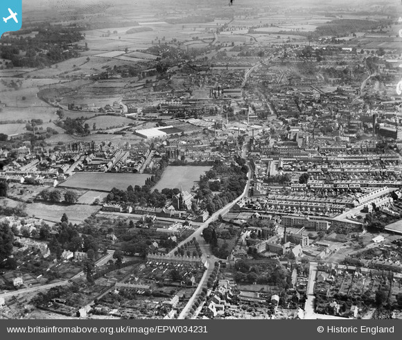
EPW034231 ENGLAND (1930). Bewdley Road and environs, Kidderminster, 1930
© Copyright OpenStreetMap contributors and licensed by the OpenStreetMap Foundation. 2025. Cartography is licensed as CC BY-SA.
Nearby Images (5)
EPW034231

EPW037595

EPW037597

EPW001291

EPW037596

Details
| Title | [EPW034231] Bewdley Road and environs, Kidderminster, 1930 |
| Reference | EPW034231 |
| Date | July-1930 |
| Link | |
| Place name | KIDDERMINSTER |
| Parish | |
| District | |
| Country | ENGLAND |
| Easting / Northing | 382551, 276730 |
| Longitude / Latitude | -2.2564184292072, 52.387938896006 |
| National Grid Reference | SO826767 |
Pins
Be the first to add a comment to this image!