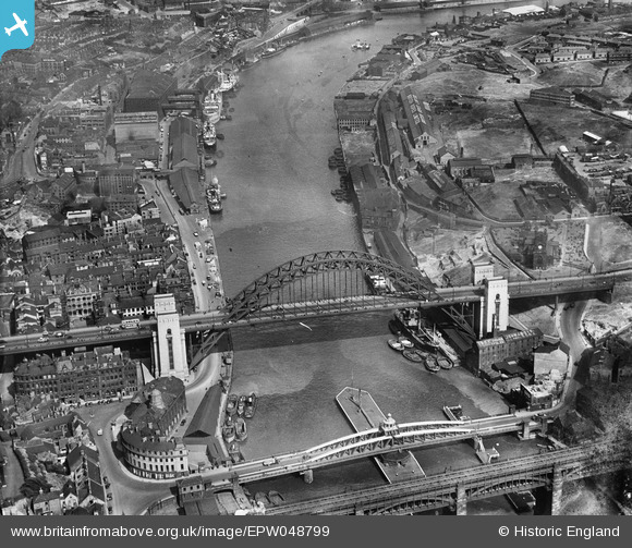
EPW048799 ENGLAND (1935). The Tyne Bridge, Newcastle Swing Bridge and environs, Newcastle Upon Tyne, 1935
© Copyright OpenStreetMap contributors and licensed by the OpenStreetMap Foundation. 2025. Cartography is licensed as CC BY-SA.
Nearby Images (27)
Details
| Title | [EPW048799] The Tyne Bridge, Newcastle Swing Bridge and environs, Newcastle Upon Tyne, 1935 |
| Reference | EPW048799 |
| Date | August-1935 |
| Link | |
| Place name | NEWCASTLE UPON TYNE |
| Parish | |
| District | |
| Country | ENGLAND |
| Easting / Northing | 425399, 563825 |
| Longitude / Latitude | -1.6032184539918, 54.968323314567 |
| National Grid Reference | NZ254638 |
Pins
 John Wass |
Sunday 27th of October 2019 02:44:19 PM | |
 Chells809 |
Friday 8th of September 2017 10:00:11 PM | |
 MB |
Friday 18th of April 2014 05:47:59 PM | |
 MB |
Friday 18th of April 2014 05:44:51 PM | |
 MB |
Friday 18th of April 2014 05:42:56 PM | |
 Dylan Moore |
Sunday 5th of May 2013 09:35:56 PM |
User Comment Contributions
From the NewcastleGateshead online guide: 'The Tyne Bridge was designed by the engineering firm Mott, Hay and Anderson [forerunner of today's MottMacDonald]and was built by Dorman Long and Co. of Middlesbrough who later went on to build Sydney Harbour Bridge, which opened three years later in 1932.' |
 MB |
Friday 18th of April 2014 05:47:08 PM |
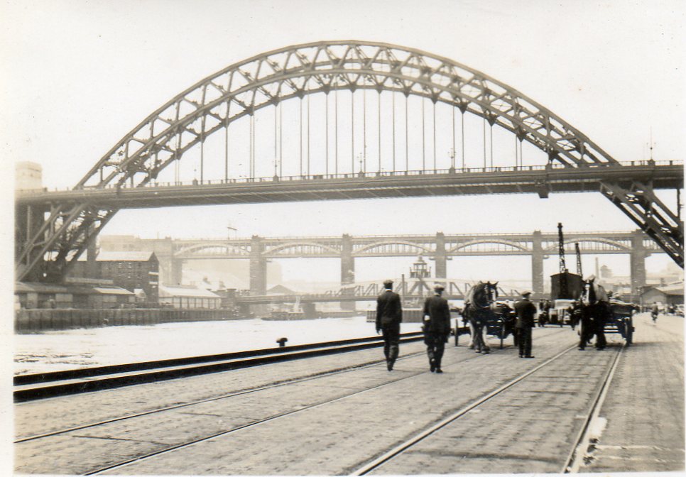
 Snapshot taken from Quayside June or July 1939 |
 Class31 |
Monday 7th of April 2014 03:57:21 PM |
View looking east. |
 Class31 |
Monday 7th of April 2014 03:56:04 PM |


![[EPW048799] The Tyne Bridge, Newcastle Swing Bridge and environs, Newcastle Upon Tyne, 1935](http://britainfromabove.org.uk/sites/all/libraries/aerofilms-images/public/100x100/EPW/048/EPW048799.jpg)
![[EPW025015] Newcastle-upon-Tyne, the day of the opening of the Tyne Bridge, 1928](http://britainfromabove.org.uk/sites/all/libraries/aerofilms-images/public/100x100/EPW/025/EPW025015.jpg)
![[EPW048805] The High Level Bridge, Newcastle Swing Bridge, Tyne Bridge and the city, Newcastle upon Tyne, from the south-west, 1935. This image has been produced from a print.](http://britainfromabove.org.uk/sites/all/libraries/aerofilms-images/public/100x100/EPW/048/EPW048805.jpg)
![[EPW048263] Tyne Bridge and the surrounding urban area, Newcastle upon Tyne, 1935. This image has been produced from a damaged negative.](http://britainfromabove.org.uk/sites/all/libraries/aerofilms-images/public/100x100/EPW/048/EPW048263.jpg)
![[EPW020569] The Tyne Bridge under construction, Newcastle Upon Tyne, 1928](http://britainfromabove.org.uk/sites/all/libraries/aerofilms-images/public/100x100/EPW/020/EPW020569.jpg)
![[EPW020570] The Tyne Bridge under construction, Newcastle Upon Tyne, 1928](http://britainfromabove.org.uk/sites/all/libraries/aerofilms-images/public/100x100/EPW/020/EPW020570.jpg)
![[EPW048345] The Tyne Bridge, Newcastle Swing Bridge and the River Tyne, Newcastle upon Tyne, 1935](http://britainfromabove.org.uk/sites/all/libraries/aerofilms-images/public/100x100/EPW/048/EPW048345.jpg)
![[EPW025016] Newcastle-upon-Tyne, the day of the opening of the Tyne Bridge, 1928. This image has been produced from a copy-negative.](http://britainfromabove.org.uk/sites/all/libraries/aerofilms-images/public/100x100/EPW/025/EPW025016.jpg)
![[EPW054561] The Tyne Bridge, Newcastle Swing Bridge and the High Level Bridge, Newcastle upon Tyne, 1937](http://britainfromabove.org.uk/sites/all/libraries/aerofilms-images/public/100x100/EPW/054/EPW054561.jpg)
![[EPW019820] Newcastle Swing Bridge, High Level Railway Bridge and Tyne Bridge under construction, Newcastle upon Tyne, 1927](http://britainfromabove.org.uk/sites/all/libraries/aerofilms-images/public/100x100/EPW/019/EPW019820.jpg)
![[EPW020568] The Tyne Bridge under construction and the Newcastle Swing Bridge, Newcastle Upon Tyne, 1928](http://britainfromabove.org.uk/sites/all/libraries/aerofilms-images/public/100x100/EPW/020/EPW020568.jpg)
![[EPW048803] Tyne Bridge, the Quayside and environs, Newcastle Upon Tyne, 1935. This image has been produced from a copy-negative.](http://britainfromabove.org.uk/sites/all/libraries/aerofilms-images/public/100x100/EPW/048/EPW048803.jpg)
![[EPW048229] Tyne Bridge, Newcastle upon Tyne, 1935. This image has been produced from a damaged negative.](http://britainfromabove.org.uk/sites/all/libraries/aerofilms-images/public/100x100/EPW/048/EPW048229.jpg)
![[EPW054559] The Tyne Bridge, Newcastle Swing Bridge and the High Level Bridge, Newcastle upon Tyne, 1937](http://britainfromabove.org.uk/sites/all/libraries/aerofilms-images/public/100x100/EPW/054/EPW054559.jpg)
![[EPW048346] The Tyne Bridge, Newcastle Swing Bridge and the High Level Bridge, Newcastle upon Tyne, 1935](http://britainfromabove.org.uk/sites/all/libraries/aerofilms-images/public/100x100/EPW/048/EPW048346.jpg)
![[EPW048235] Tyne Bridge, Gateshead, 1935](http://britainfromabove.org.uk/sites/all/libraries/aerofilms-images/public/100x100/EPW/048/EPW048235.jpg)
![[EPW051090] High Street and environs, Gateshead, from the north, 1936](http://britainfromabove.org.uk/sites/all/libraries/aerofilms-images/public/100x100/EPW/051/EPW051090.jpg)
![[EPW048230] The Close Engineering Works, Tyne Bridge and environs, Gateshead, 1935](http://britainfromabove.org.uk/sites/all/libraries/aerofilms-images/public/100x100/EPW/048/EPW048230.jpg)
![[EPW019832] The Tyne Bridge under construction, Gateshead, 1927](http://britainfromabove.org.uk/sites/all/libraries/aerofilms-images/public/100x100/EPW/019/EPW019832.jpg)
![[EPW051088] The British Ropes Ltd Wire Works, Gateshead, 1936](http://britainfromabove.org.uk/sites/all/libraries/aerofilms-images/public/100x100/EPW/051/EPW051088.jpg)
![[EPW010393] The High Level Bridge and Newcastle Swing Bridge, Newcastle upon Tyne, 1924. This image has been produced from a print.](http://britainfromabove.org.uk/sites/all/libraries/aerofilms-images/public/100x100/EPW/010/EPW010393.jpg)
![[EPW048800] The High Level Bridge, Newcastle Swing Bridge and Tyne Bridge, Newcastle Upon Tyne, 1935. This image has been produced from a copy-negative.](http://britainfromabove.org.uk/sites/all/libraries/aerofilms-images/public/100x100/EPW/048/EPW048800.jpg)
![[EPW048801] The High Level Bridge, Newcastle Swing Bridge, Tyne Bridge and the city, Newcastle upon Tyne, 1935. This image has been produced from a print.](http://britainfromabove.org.uk/sites/all/libraries/aerofilms-images/public/100x100/EPW/048/EPW048801.jpg)
![[EPW010383] All Saints' Church and environs, Newcastle upon Tyne, 1924. This image has been produced from a print.](http://britainfromabove.org.uk/sites/all/libraries/aerofilms-images/public/100x100/EPW/010/EPW010383.jpg)
![[EAW405203] Bridges over the River Tyne, Newcastle upon Tyne, from the north-east, 1981](http://britainfromabove.org.uk/sites/all/libraries/aerofilms-images/public/100x100/EAW/405/EAW405203.jpg)
![[EAW017459] Carliol Square, Grey Street and Pilgrim Street, Newcastle upon Tyne, 1948. This image has been produced from a print.](http://britainfromabove.org.uk/sites/all/libraries/aerofilms-images/public/100x100/EAW/017/EAW017459.jpg)
![[EAW600907] Tyne Bridge, Newcastle upon Tyne, 1991](http://britainfromabove.org.uk/sites/all/libraries/aerofilms-images/public/100x100/EAW/600/EAW600907.jpg)