
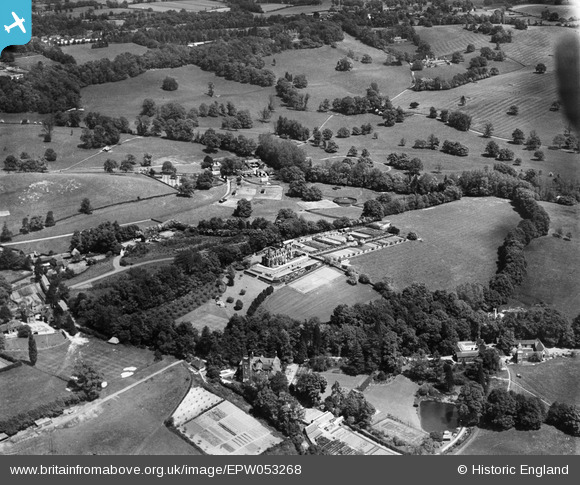
EPW053268 ENGLAND (1937). High Beech House and environs, South Nutfield, 1937
© Copyright OpenStreetMap contributors and licensed by the OpenStreetMap Foundation. 2025. Cartography is licensed as CC BY-SA.
Nearby Images (7)
EPW053268

EPW053270

EPW053269

EPW053274

EPW053273

EPW053272

EPW053266

Details
| Title | [EPW053268] High Beech House and environs, South Nutfield, 1937 |
| Reference | EPW053268 |
| Date | 27-May-1937 |
| Link | |
| Place name | SOUTH NUTFIELD |
| Parish | NUTFIELD |
| District | |
| Country | ENGLAND |
| Easting / Northing | 531359, 149767 |
| Longitude / Latitude | -0.11835005095967, 51.23143673889 |
| National Grid Reference | TQ314498 |
Pins
 Nutfield_warbler |
Friday 10th of July 2015 10:31:51 PM | |
Derek |
Saturday 29th of November 2014 06:12:07 AM |