
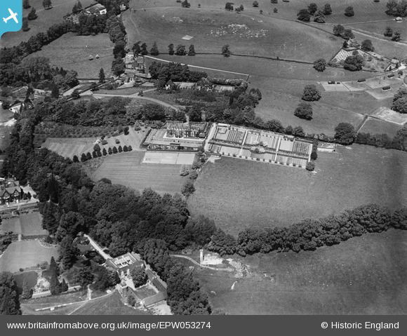
EPW053274 ENGLAND (1937). High Beech House and environs, South Nutfield, 1937
© Copyright OpenStreetMap contributors and licensed by the OpenStreetMap Foundation. 2025. Cartography is licensed as CC BY-SA.
Nearby Images (8)
EPW053274

EPW053268

EPW053270

EPW053269

EPW053266

EPW053273

EPW053267

EPW053272

Details
| Title | [EPW053274] High Beech House and environs, South Nutfield, 1937 |
| Reference | EPW053274 |
| Date | 27-May-1937 |
| Link | |
| Place name | SOUTH NUTFIELD |
| Parish | NUTFIELD |
| District | |
| Country | ENGLAND |
| Easting / Northing | 531353, 149678 |
| Longitude / Latitude | -0.11846858274791, 51.230638182246 |
| National Grid Reference | TQ314497 |
Pins
Be the first to add a comment to this image!
User Comment Contributions
High Beech was built between 1912-1914 by Robert Leonard Carter and his wife Rachel Mary Duncan nee Robertson. My grandparents were deeply committed Christians and philanthropic in their outlook. They had a continuous flow of visitors throughout their residence at High Beech. It was a very happy and loving home. |
 Richenda |
Wednesday 4th of May 2016 11:30:46 PM |