
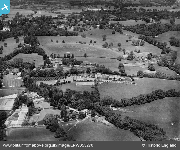
EPW053270 ENGLAND (1937). High Beech House and environs, South Nutfield, 1937
© Copyright OpenStreetMap contributors and licensed by the OpenStreetMap Foundation. 2025. Cartography is licensed as CC BY-SA.
Nearby Images (11)
EPW053270

EPW053269

EPW053268

EPW053274

EPW053273

EPW053272

EPW053266

EPW053267

EPW053275

EPW053271

EPW053276

Details
| Title | [EPW053270] High Beech House and environs, South Nutfield, 1937 |
| Reference | EPW053270 |
| Date | 27-May-1937 |
| Link | |
| Place name | SOUTH NUTFIELD |
| Parish | NUTFIELD |
| District | |
| Country | ENGLAND |
| Easting / Northing | 531314, 149776 |
| Longitude / Latitude | -0.1189909808861, 51.23152798996 |
| National Grid Reference | TQ313498 |
