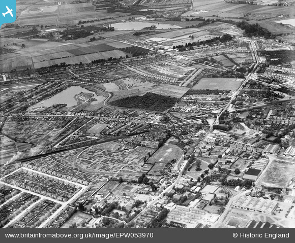
EPW053970 ENGLAND (1937). The town, Feltham, 1937
© Copyright OpenStreetMap contributors and licensed by the OpenStreetMap Foundation. 2025. Cartography is licensed as CC BY-SA.
Details
| Title | [EPW053970] The town, Feltham, 1937 |
| Reference | EPW053970 |
| Date | June-1937 |
| Link | |
| Place name | FELTHAM |
| Parish | |
| District | |
| Country | ENGLAND |
| Easting / Northing | 510434, 173431 |
| Longitude / Latitude | -0.41061339791476, 51.448593826518 |
| National Grid Reference | TQ104734 |
Pins
 The Laird |
Wednesday 9th of February 2022 01:40:21 AM | |
 The Laird |
Wednesday 9th of February 2022 01:36:21 AM | |
 intothefireuk |
Wednesday 14th of September 2016 10:39:35 PM | |
 Chris |
Saturday 12th of March 2016 03:30:33 PM | |
 Chris |
Saturday 12th of March 2016 03:28:44 PM | |
 Chris |
Saturday 12th of March 2016 03:27:50 PM | |
 Chris |
Saturday 12th of March 2016 03:27:11 PM | |
 Chris |
Saturday 12th of March 2016 03:26:25 PM |


![[EPW053970] The town, Feltham, 1937](http://britainfromabove.org.uk/sites/all/libraries/aerofilms-images/public/100x100/EPW/053/EPW053970.jpg)
![[EPW053973] The town, Feltham, 1937](http://britainfromabove.org.uk/sites/all/libraries/aerofilms-images/public/100x100/EPW/053/EPW053973.jpg)
![[EPW023382] Feltham Railway Station and environs, Feltham, 1928](http://britainfromabove.org.uk/sites/all/libraries/aerofilms-images/public/100x100/EPW/023/EPW023382.jpg)