
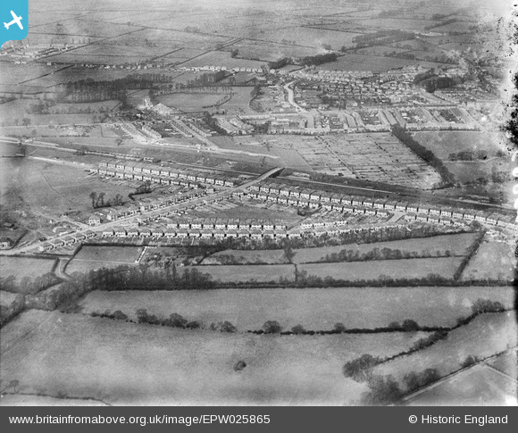
EPW025865 ENGLAND (1929). New housing at Wood End, Northolt, 1929
© Copyright OpenStreetMap contributors and licensed by the OpenStreetMap Foundation. 2024. Cartography is licensed as CC BY-SA.
Nearby Images (10)
EPW025865

EPW025866

EPW025871

EPW025862

EPW025867

EPW025869

EPW025868

EPW025870

EPW025864

EPW025863

Details
| Title | [EPW025865] New housing at Wood End, Northolt, 1929 |
| Reference | EPW025865 |
| Date | March-1929 |
| Link | |
| Place name | NORTHOLT |
| Parish | |
| District | |
| Country | ENGLAND |
| Easting / Northing | 514329, 185567 |
| Longitude / Latitude | -0.35064591611178, 51.556908549001 |
| National Grid Reference | TQ143856 |
Pins
 Paul Gleave |
Sunday 17th of July 2016 08:07:20 AM |