
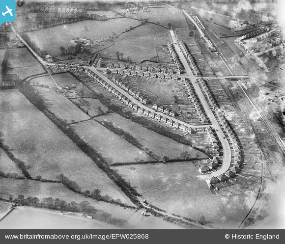
EPW025868 ENGLAND (1929). New housing at Wood End, Northolt, 1929
© Copyright OpenStreetMap contributors and licensed by the OpenStreetMap Foundation. 2024. Cartography is licensed as CC BY-SA.
Nearby Images (10)
EPW025868

EPW025869

EPW025870

EPW025864

EPW025863

EPW025871

EPW025862

EPW025866

EPW025867

EPW025865

Details
| Title | [EPW025868] New housing at Wood End, Northolt, 1929 |
| Reference | EPW025868 |
| Date | March-1929 |
| Link | |
| Place name | NORTHOLT |
| Parish | |
| District | |
| Country | ENGLAND |
| Easting / Northing | 514458, 185506 |
| Longitude / Latitude | -0.3488056036005, 51.556334073844 |
| National Grid Reference | TQ145855 |
Pins
 Class31 |
Friday 28th of September 2012 08:07:56 PM | |
Class31 |
Friday 28th of September 2012 08:07:00 PM | |
Class31 |
Friday 28th of September 2012 08:06:28 PM | |
Class31 |
Friday 28th of September 2012 08:06:11 PM | |
Class31 |
Friday 28th of September 2012 08:05:54 PM | |
Class31 |
Friday 28th of September 2012 08:05:35 PM |