
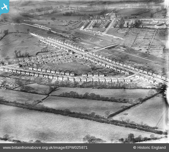
EPW025871 ENGLAND (1929). New housing at Wood End, Northolt, 1929
© Copyright OpenStreetMap contributors and licensed by the OpenStreetMap Foundation. 2024. Cartography is licensed as CC BY-SA.
Nearby Images (10)
EPW025871

EPW025866

EPW025869

EPW025868

EPW025862

EPW025870

EPW025864

EPW025867

EPW025863

EPW025865

Details
| Title | [EPW025871] New housing at Wood End, Northolt, 1929 |
| Reference | EPW025871 |
| Date | March-1929 |
| Link | |
| Place name | NORTHOLT |
| Parish | |
| District | |
| Country | ENGLAND |
| Easting / Northing | 514413, 185550 |
| Longitude / Latitude | -0.34944017339461, 51.556738706683 |
| National Grid Reference | TQ144856 |
Pins
 Class31 |
Friday 28th of September 2012 07:57:37 PM | |
Class31 |
Friday 28th of September 2012 07:51:52 PM | |
Class31 |
Friday 28th of September 2012 07:51:03 PM | |
Class31 |
Friday 28th of September 2012 07:50:34 PM | |
Class31 |
Friday 28th of September 2012 07:50:14 PM | |
Class31 |
Friday 28th of September 2012 07:49:41 PM | |
Class31 |
Friday 28th of September 2012 07:49:17 PM |