
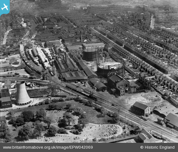
EPW042069 ENGLAND (1933). Grimsby Gas Works and environs, Grimsby, 1933
© Copyright OpenStreetMap contributors and licensed by the OpenStreetMap Foundation. 2024. Cartography is licensed as CC BY-SA.
Nearby Images (13)
EPW042069

EPW042068

EPW042067

EPW042066

EPW042071

EPW053392

EPW042070

EAW052054

EAW052052

EAW052049

EAW052051

EPW042804

EAW052053

Details
| Title | [EPW042069] Grimsby Gas Works and environs, Grimsby, 1933 |
| Reference | EPW042069 |
| Date | June-1933 |
| Link | |
| Place name | GRIMSBY |
| Parish | |
| District | |
| Country | ENGLAND |
| Easting / Northing | 527335, 409074 |
| Longitude / Latitude | -0.077230132200404, 53.562567513981 |
| National Grid Reference | TA273091 |
