
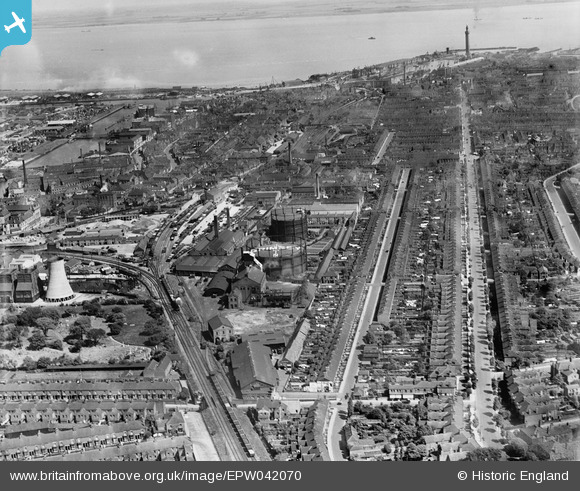
EPW042070 ENGLAND (1933). Grimsby Gas Works and the town, Grimsby, from the south, 1933
© Copyright OpenStreetMap contributors and licensed by the OpenStreetMap Foundation. 2024. Cartography is licensed as CC BY-SA.
Nearby Images (11)
EPW042070

EPW042067

EPW053392

EPW042069

EPW042068

EPW042066

EPW042071

EAW052054

EAW052052

EAW052049

EAW052051

Details
| Title | [EPW042070] Grimsby Gas Works and the town, Grimsby, from the south, 1933 |
| Reference | EPW042070 |
| Date | June-1933 |
| Link | |
| Place name | GRIMSBY |
| Parish | |
| District | |
| Country | ENGLAND |
| Easting / Northing | 527388, 408921 |
| Longitude / Latitude | -0.076492705257706, 53.56118005311 |
| National Grid Reference | TA274089 |
Pins
 John Wass |
Saturday 1st of October 2016 07:59:23 PM | |
 Class31 |
Monday 1st of September 2014 08:01:44 PM | |
Class31 |
Monday 1st of September 2014 08:00:50 PM | |
Class31 |
Tuesday 4th of March 2014 08:46:38 AM | |
Class31 |
Tuesday 4th of March 2014 08:36:41 AM | |
Class31 |
Tuesday 4th of March 2014 08:34:45 AM | |
Class31 |
Tuesday 4th of March 2014 08:33:27 AM | |
Class31 |
Tuesday 4th of March 2014 08:32:50 AM | |
Class31 |
Tuesday 4th of March 2014 08:32:17 AM | |
Class31 |
Tuesday 4th of March 2014 08:31:25 AM | |
Class31 |
Tuesday 4th of March 2014 08:31:06 AM | |
Class31 |
Tuesday 4th of March 2014 08:29:42 AM | |
Class31 |
Tuesday 4th of March 2014 08:25:07 AM |


User Comment Contributions
View looking north. |
Class31 |
Tuesday 4th of March 2014 08:39:57 AM |