
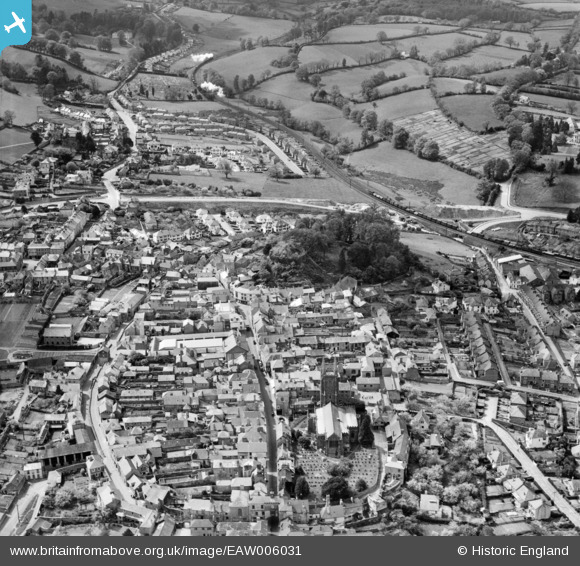
EAW006031 ENGLAND (1947). St Mary's Church, Totnes Castle and the town centre, Totnes, 1947
© Copyright OpenStreetMap contributors and licensed by the OpenStreetMap Foundation. 2025. Cartography is licensed as CC BY-SA.
Nearby Images (8)
EAW006031

EAW006029

EAW006033

EAW006030

EPW011315

EPW054791

EPW054790

EAW006032

Details
| Title | [EAW006031] St Mary's Church, Totnes Castle and the town centre, Totnes, 1947 |
| Reference | EAW006031 |
| Date | 18-May-1947 |
| Link | |
| Place name | TOTNES |
| Parish | TOTNES |
| District | |
| Country | ENGLAND |
| Easting / Northing | 280039, 60491 |
| Longitude / Latitude | -3.6892343172783, 50.431395634508 |
| National Grid Reference | SX800605 |
Pins
 Ginny |
Monday 8th of June 2020 12:24:27 PM | |
Alan R |
Sunday 1st of March 2015 04:08:45 PM | |
Sarah Hoile |
Friday 27th of June 2014 12:33:49 PM | |
MB |
Thursday 7th of November 2013 08:51:21 PM | |
MB |
Thursday 7th of November 2013 08:49:43 PM | |
MB |
Thursday 7th of November 2013 08:47:34 PM |