
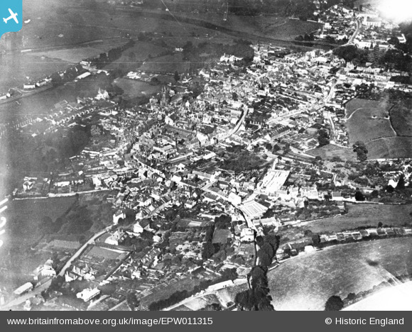
EPW011315 ENGLAND (1924). The town, Totnes, 1924. This image has been produced from a print.
© Copyright OpenStreetMap contributors and licensed by the OpenStreetMap Foundation. 2025. Cartography is licensed as CC BY-SA.
Nearby Images (7)
EPW011315

EAW006031

EAW006029

EAW006030

EPW054791

EAW006033

EPW054790

Details
| Title | [EPW011315] The town, Totnes, 1924. This image has been produced from a print. |
| Reference | EPW011315 |
| Date | July-1924 |
| Link | |
| Place name | TOTNES |
| Parish | TOTNES |
| District | |
| Country | ENGLAND |
| Easting / Northing | 280059, 60350 |
| Longitude / Latitude | -3.6889077091354, 50.430132097256 |
| National Grid Reference | SX801604 |
Pins
 Kate Burhouse |
Wednesday 5th of February 2025 12:52:58 PM |