
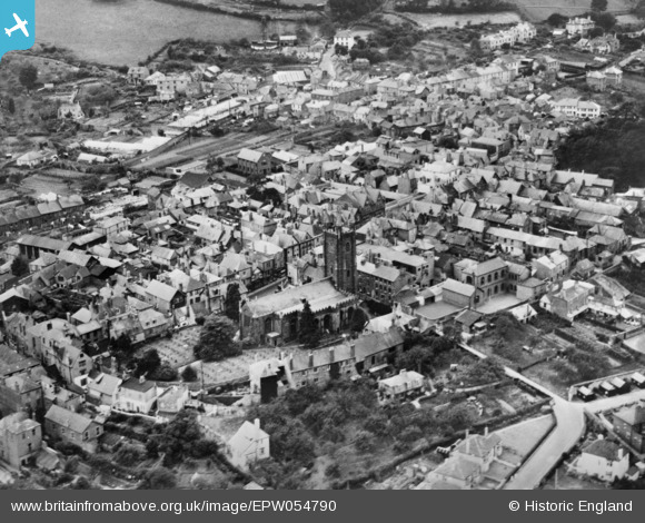
EPW054790 ENGLAND (1937). St Mary's Church and the High Street, Totnes, 1937. This image has been produced from a copy-negative.
© Copyright OpenStreetMap contributors and licensed by the OpenStreetMap Foundation. 2025. Cartography is licensed as CC BY-SA.
Nearby Images (7)
EPW054790

EPW054791

EAW006031

EPW011315

EAW006033

EAW006029

EAW006030

Details
| Title | [EPW054790] St Mary's Church and the High Street, Totnes, 1937. This image has been produced from a copy-negative. |
| Reference | EPW054790 |
| Date | August-1937 |
| Link | |
| Place name | TOTNES |
| Parish | TOTNES |
| District | |
| Country | ENGLAND |
| Easting / Northing | 280206, 60465 |
| Longitude / Latitude | -3.6868754787972, 50.431195995911 |
| National Grid Reference | SX802605 |
Pins
Be the first to add a comment to this image!