
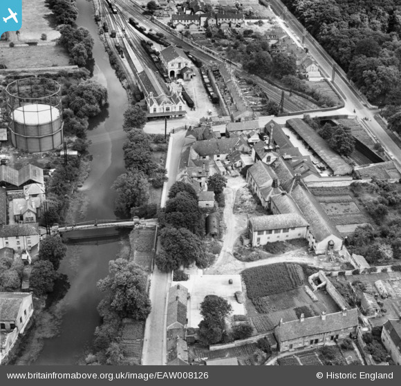
EAW008126 ENGLAND (1947). Albert Bridge, Water Street, the railway terminus and envrions, Stamford, 1947
© Copyright OpenStreetMap contributors and licensed by the OpenStreetMap Foundation. 2025. Cartography is licensed as CC BY-SA.
Nearby Images (10)
EAW008126

EAW008127

EAW008125

EAW008130

EAW008132

EAW008128

EAW008129

EAW008131

EPW054984

EPW054983

Details
| Title | [EAW008126] Albert Bridge, Water Street, the railway terminus and envrions, Stamford, 1947 |
| Reference | EAW008126 |
| Date | 12-July-1947 |
| Link | |
| Place name | STAMFORD |
| Parish | STAMFORD |
| District | |
| Country | ENGLAND |
| Easting / Northing | 503376, 306889 |
| Longitude / Latitude | -0.47176227238337, 52.649520333041 |
| National Grid Reference | TF034069 |
Pins
 diag |
Saturday 26th of July 2014 09:13:37 PM | |
diag |
Saturday 26th of July 2014 09:11:39 PM | |
Closed 1957. |
John W |
Tuesday 28th of June 2016 04:37:54 PM |
MB |
Tuesday 31st of December 2013 09:07:44 AM | |
MB |
Tuesday 31st of December 2013 09:07:17 AM | |
MB |
Tuesday 31st of December 2013 09:06:54 AM | |
MB |
Tuesday 31st of December 2013 09:02:35 AM | |
MB |
Tuesday 31st of December 2013 09:02:08 AM |