
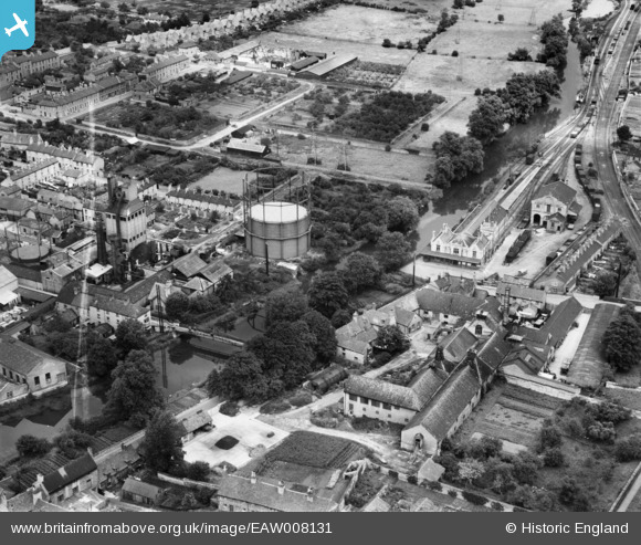
EAW008131 ENGLAND (1947). Brewery and malt house buildings between Barnack Road and Water Street, the railway terminus and gas works, Stamford, 1947. This image was marked by Aerofilms Ltd for photo editing.
© Copyright OpenStreetMap contributors and licensed by the OpenStreetMap Foundation. 2025. Cartography is licensed as CC BY-SA.
Nearby Images (10)
EAW008131

EAW008130

EAW008126

EAW008132

EAW008127

EAW008125

EAW008128

EAW008129

EPW054984

EPW054983

Details
| Title | [EAW008131] Brewery and malt house buildings between Barnack Road and Water Street, the railway terminus and gas works, Stamford, 1947. This image was marked by Aerofilms Ltd for photo editing. |
| Reference | EAW008131 |
| Date | 12-July-1947 |
| Link | |
| Place name | STAMFORD |
| Parish | STAMFORD |
| District | |
| Country | ENGLAND |
| Easting / Northing | 503411, 306956 |
| Longitude / Latitude | -0.47122405183002, 52.650115826132 |
| National Grid Reference | TF034070 |
Pins
Be the first to add a comment to this image!