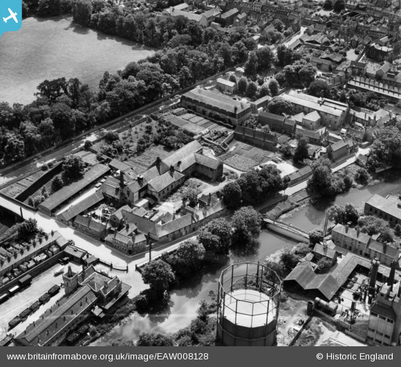
EAW008128 ENGLAND (1947). Brewery and malt house buildings between Barnack Road and Water Street, Stamford, 1947. This image was marked by Aerofilms Ltd for photo editing.
© Copyright OpenStreetMap contributors and licensed by the OpenStreetMap Foundation. 2025. Cartography is licensed as CC BY-SA.
Nearby Images (10)
EAW008128

EAW008129

EAW008125

EAW008127

EAW008126

EAW008132

EAW008130

EAW008131

EPW054984

EPW054983

Details
| Title | [EAW008128] Brewery and malt house buildings between Barnack Road and Water Street, Stamford, 1947. This image was marked by Aerofilms Ltd for photo editing. |
| Reference | EAW008128 |
| Date | 12-July-1947 |
| Link | |
| Place name | STAMFORD |
| Parish | STAMFORD |
| District | |
| Country | ENGLAND |
| Easting / Northing | 503350, 306857 |
| Longitude / Latitude | -0.47215651565436, 52.649237686673 |
| National Grid Reference | TF034069 |