
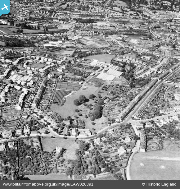
EAW026391 ENGLAND (1949). Matthew Coombe and Sons Southdown Nursery and environs, Southdown, 1949
© Copyright OpenStreetMap contributors and licensed by the OpenStreetMap Foundation. 2025. Cartography is licensed as CC BY-SA.
Nearby Images (18)
EAW026391

EAW032286

EAW032288

EAW032290

EAW026392

EAW026389

EPW022216

EAW032292

EAW032287

EAW026390

EAW032291

EAW032289

EAW026393

EAW026394

EPW022215

EPW048401

EPW022213

EPW022217

Details
| Title | [EAW026391] Matthew Coombe and Sons Southdown Nursery and environs, Southdown, 1949 |
| Reference | EAW026391 |
| Date | 8-September-1949 |
| Link | |
| Place name | SOUTHDOWN |
| Parish | |
| District | |
| Country | ENGLAND |
| Easting / Northing | 373021, 163477 |
| Longitude / Latitude | -2.3876046090296, 51.369213303853 |
| National Grid Reference | ST730635 |
