
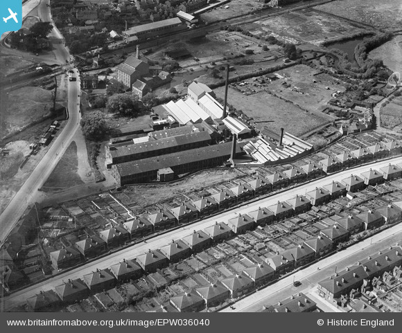
EPW036040 ENGLAND (1931). The Bobbers Mill Bleaching and Dyeing Works and Chadwick Road, Nottingham, 1931
© Copyright OpenStreetMap contributors and licensed by the OpenStreetMap Foundation. 2025. Cartography is licensed as CC BY-SA.
Nearby Images (16)
EPW036040

EPW036043

EPW036042

EPW036039

EPW036047

EPW036045

EPW036048

EPW036046

EPW036044

EPW036041

EPW054123

EPW054120

EPW054121

EPW054124

EPW054122

EPW054119

Details
| Title | [EPW036040] The Bobbers Mill Bleaching and Dyeing Works and Chadwick Road, Nottingham, 1931 |
| Reference | EPW036040 |
| Date | July-1931 |
| Link | |
| Place name | NOTTINGHAM |
| Parish | |
| District | |
| Country | ENGLAND |
| Easting / Northing | 455146, 341345 |
| Longitude / Latitude | -1.1788311547806, 52.966315237027 |
| National Grid Reference | SK551413 |
Pins
 MB |
Tuesday 18th of June 2013 06:43:35 PM |
User Comment Contributions
The mill appears to be steam powered but was very possibly water powered originally |
MB |
Tuesday 18th of June 2013 06:46:08 PM |