
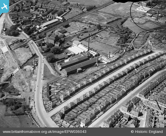
EPW036043 ENGLAND (1931). The Bobbers Mill Bleaching and Dyeing Works, Chadwick Road and Bobbers Mill Bridge under construction, Nottingham, 1931
© Copyright OpenStreetMap contributors and licensed by the OpenStreetMap Foundation. 2025. Cartography is licensed as CC BY-SA.
Nearby Images (16)
EPW036043

EPW036040

EPW036042

EPW036039

EPW036045

EPW036047

EPW036044

EPW036048

EPW036041

EPW036046

EPW054123

EPW054120

EPW054121

EPW054122

EPW054124

EPW054119

Details
| Title | [EPW036043] The Bobbers Mill Bleaching and Dyeing Works, Chadwick Road and Bobbers Mill Bridge under construction, Nottingham, 1931 |
| Reference | EPW036043 |
| Date | July-1931 |
| Link | |
| Place name | NOTTINGHAM |
| Parish | |
| District | |
| Country | ENGLAND |
| Easting / Northing | 455139, 341337 |
| Longitude / Latitude | -1.1789367414891, 52.966244042206 |
| National Grid Reference | SK551413 |
Pins
 Nightstrangler |
Wednesday 8th of August 2018 01:18:47 PM |