
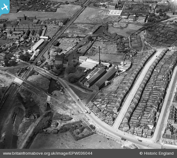
EPW036044 ENGLAND (1931). The Bobbers Mill Bleaching and Dyeing Works, Chadwick Road and Bobbers Mill Bridge under construction, Nottingham, 1931
© Copyright OpenStreetMap contributors and licensed by the OpenStreetMap Foundation. 2025. Cartography is licensed as CC BY-SA.
Nearby Images (16)
EPW036044

EPW036041

EPW036039

EPW036042

EPW036045

EPW036047

EPW036043

EPW036048

EPW036040

EPW036046

EPW054123

EPW054124

EPW054120

EPW054121

EPW054122

EPW054119

Details
| Title | [EPW036044] The Bobbers Mill Bleaching and Dyeing Works, Chadwick Road and Bobbers Mill Bridge under construction, Nottingham, 1931 |
| Reference | EPW036044 |
| Date | July-1931 |
| Link | |
| Place name | NOTTINGHAM |
| Parish | |
| District | |
| Country | ENGLAND |
| Easting / Northing | 455107, 341356 |
| Longitude / Latitude | -1.1794099588392, 52.966418129741 |
| National Grid Reference | SK551414 |
