
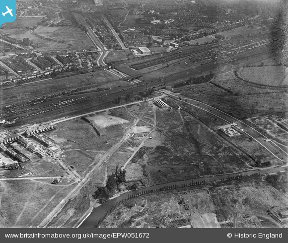
EPW051672 ENGLAND (1936). Brent Junction and environs, Alperton, 1936
© Copyright OpenStreetMap contributors and licensed by the OpenStreetMap Foundation. 2025. Cartography is licensed as CC BY-SA.
Nearby Images (23)
EPW051672

EPW052467

EPW056366

EPW056467

EPW056468

EPW052465

EPW051679

EPW056469

EPW053022

EPW053017

EPW056470

EPW051676

EPW053018

EPW051675

EPW051677

EPW053021

EPW051678

EPW051674

EPW053019

EPW053016

EPW051680

EPW056086

EPW056464

Details
| Title | [EPW051672] Brent Junction and environs, Alperton, 1936 |
| Reference | EPW051672 |
| Date | August-1936 |
| Link | |
| Place name | ALPERTON |
| Parish | |
| District | |
| Country | ENGLAND |
| Easting / Northing | 519386, 183902 |
| Longitude / Latitude | -0.27829155178422, 51.540895117463 |
| National Grid Reference | TQ194839 |
Pins
 Nowy Paul |
Saturday 6th of January 2018 03:27:19 PM | |
bondi |
Thursday 29th of October 2015 09:33:06 PM | |
 greenchief |
Monday 13th of January 2014 03:31:39 PM | |
greenchief |
Monday 13th of January 2014 03:26:32 PM | |
greenchief |
Monday 13th of January 2014 03:24:46 PM | |
csunderland |
Thursday 16th of May 2013 01:36:37 AM | |
csunderland |
Thursday 16th of May 2013 01:35:51 AM | |
csunderland |
Thursday 16th of May 2013 01:30:37 AM | |
csunderland |
Thursday 16th of May 2013 01:30:05 AM | |
csunderland |
Thursday 16th of May 2013 01:23:40 AM | |
csunderland |
Thursday 16th of May 2013 01:20:23 AM | |
csunderland |
Thursday 16th of May 2013 01:19:51 AM |