
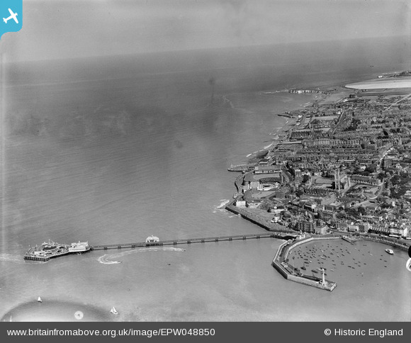
EPW048850 ENGLAND (1935). Margate Jetty, the seafront and the town, Margate, from the west, 1935
© Copyright OpenStreetMap contributors and licensed by the OpenStreetMap Foundation. 2024. Cartography is licensed as CC BY-SA.
Nearby Images (13)
EPW048850

EPW048851

EPW000633

EPW042849

EPW035470

EPW000638

EPW035467

EPW048848

EPW018601

EPW009239

EAW015840

EPW000627

EPW000631

Details
| Title | [EPW048850] Margate Jetty, the seafront and the town, Margate, from the west, 1935 |
| Reference | EPW048850 |
| Date | August-1935 |
| Link | |
| Place name | MARGATE |
| Parish | |
| District | |
| Country | ENGLAND |
| Easting / Northing | 635558, 171475 |
| Longitude / Latitude | 1.3864105279687, 51.392834158864 |
| National Grid Reference | TR356715 |
Pins
Be the first to add a comment to this image!