
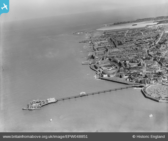
EPW048851 ENGLAND (1935). Margate Jetty, the seafront and the town, Margate, from the north-west, 1935
© Copyright OpenStreetMap contributors and licensed by the OpenStreetMap Foundation. 2024. Cartography is licensed as CC BY-SA.
Nearby Images (13)
EPW048851

EPW035467

EPW048850

EPW018601

EPW000619

EAW015840

EPW000627

EPW000633

EPW048849

EPW009163

EPW000631

EPW042849

EPW035470

Details
| Title | [EPW048851] Margate Jetty, the seafront and the town, Margate, from the north-west, 1935 |
| Reference | EPW048851 |
| Date | August-1935 |
| Link | |
| Place name | MARGATE |
| Parish | |
| District | |
| Country | ENGLAND |
| Easting / Northing | 635441, 171483 |
| Longitude / Latitude | 1.3847369807228, 51.39295452907 |
| National Grid Reference | TR354715 |
Pins
 mannidaze |
Friday 25th of January 2019 02:56:07 PM |