
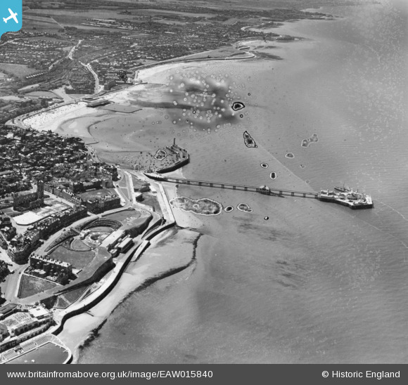
EAW015840 ENGLAND (1948). The Winter Gardens, Jetty Extension and harbour, Margate, 1948. This image has been produced from a damaged negative.
© Copyright OpenStreetMap contributors and licensed by the OpenStreetMap Foundation. 2024. Cartography is licensed as CC BY-SA.
Nearby Images (27)
EAW015840

EPW000627

EPW035467

EPW000619

EPW000631

EPW048847

EPW018599

EPW018601

EAW015841

EPW048851

EPW000625

EPW048846

EPW048689

EPW009163

EPW048684

EPW000633

EPW000162

EPW018607

EPW048690

EPW048692

EPW048849

EPW048688

EPW048850

EPW048685

EPW009240

EPW048687

EPW048691

Details
| Title | [EAW015840] The Winter Gardens, Jetty Extension and harbour, Margate, 1948. This image has been produced from a damaged negative. |
| Reference | EAW015840 |
| Date | 19-May-1948 |
| Link | |
| Place name | MARGATE |
| Parish | |
| District | |
| Country | ENGLAND |
| Easting / Northing | 635316, 171372 |
| Longitude / Latitude | 1.38286975399, 51.392009931591 |
| National Grid Reference | TR353714 |
Pins
 Lee |
Tuesday 8th of December 2020 03:02:58 AM |