
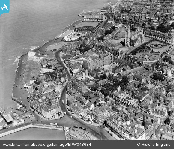
EPW048684 ENGLAND (1935). The Cobb and Co Brewery below Trinity Church and environs, Margate, 1935
© Copyright OpenStreetMap contributors and licensed by the OpenStreetMap Foundation. 2024. Cartography is licensed as CC BY-SA.
Nearby Images (27)
EPW048684

EPW048692

EPW048689

EPW048690

EPW048688

EPW048685

EPW048846

EPW048691

EPW048687

EPW048686

EPW000625

EPW018599

EPW000631

EPW000633

EPW000624

EPW048847

EPW000636

EPW048845

EPW018600

EPW000627

EPW009241

EPW018607

EAW015840

EAW015841

EPW035470

EPW000638

EPW042849

Details
| Title | [EPW048684] The Cobb and Co Brewery below Trinity Church and environs, Margate, 1935 |
| Reference | EPW048684 |
| Date | July-1935 |
| Link | |
| Place name | MARGATE |
| Parish | |
| District | |
| Country | ENGLAND |
| Easting / Northing | 635474, 171200 |
| Longitude / Latitude | 1.3850228105086, 51.390400354901 |
| National Grid Reference | TR355712 |
Pins
Be the first to add a comment to this image!