
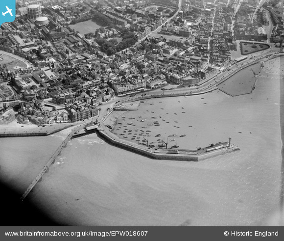
EPW018607 ENGLAND (1927). The Harbour and Parade, Margate, 1927
© Copyright OpenStreetMap contributors and licensed by the OpenStreetMap Foundation. 2024. Cartography is licensed as CC BY-SA.
Nearby Images (18)
EPW018607

EPW048845

EAW015841

EPW000625

EPW048847

EPW000162

EPW018599

EPW009241

EPW048846

EPW000631

EPW000627

EPW048684

EPW048692

EPW048691

EPW048689

EPW048690

EPW048688

EAW015840

Details
| Title | [EPW018607] The Harbour and Parade, Margate, 1927 |
| Reference | EPW018607 |
| Date | 22-June-1927 |
| Link | |
| Place name | MARGATE |
| Parish | |
| District | |
| Country | ENGLAND |
| Easting / Northing | 635262, 171131 |
| Longitude / Latitude | 1.3819352226044, 51.389868864366 |
| National Grid Reference | TR353711 |
Pins
Be the first to add a comment to this image!