
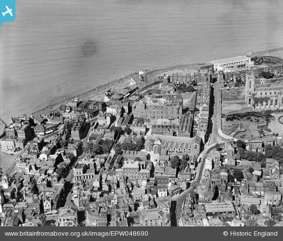
EPW048690 ENGLAND (1935). The Cobb and Co Brewery and environs, Margate, 1935
© Copyright OpenStreetMap contributors and licensed by the OpenStreetMap Foundation. 2024. Cartography is licensed as CC BY-SA.
Nearby Images (26)
EPW048690

EPW048688

EPW048692

EPW048685

EPW048689

EPW048684

EPW048687

EPW048691

EPW048686

EPW048846

EPW000624

EPW000633

EPW000625

EPW018599

EPW000636

EPW000631

EPW048847

EPW018600

EPW048845

EPW000627

EPW035470

EPW009241

EPW018607

EPW000638

EAW015840

EPW042849

Details
| Title | [EPW048690] The Cobb and Co Brewery and environs, Margate, 1935 |
| Reference | EPW048690 |
| Date | July-1935 |
| Link | |
| Place name | MARGATE |
| Parish | |
| District | |
| Country | ENGLAND |
| Easting / Northing | 635496, 171199 |
| Longitude / Latitude | 1.3853378121545, 51.390382249398 |
| National Grid Reference | TR355712 |
Pins
Be the first to add a comment to this image!