
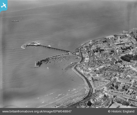
EPW048847 ENGLAND (1935). Margate Jetty, the harbour, Marine Drive and environs, Margate, 1935
© Copyright OpenStreetMap contributors and licensed by the OpenStreetMap Foundation. 2024. Cartography is licensed as CC BY-SA.
Nearby Images (23)
EPW048847

EPW018599

EPW000625

EPW000631

EAW015841

EPW048846

EPW018607

EPW000627

EAW015840

EPW048845

EPW048684

EPW000162

EPW048689

EPW048692

EPW048690

EPW048688

EPW048685

EPW048691

EPW009241

EPW035467

EPW048687

EPW000619

EPW000633

Details
| Title | [EPW048847] Margate Jetty, the harbour, Marine Drive and environs, Margate, 1935 |
| Reference | EPW048847 |
| Date | August-1935 |
| Link | |
| Place name | MARGATE |
| Parish | |
| District | |
| Country | ENGLAND |
| Easting / Northing | 635319, 171225 |
| Longitude / Latitude | 1.3828153719811, 51.390689070281 |
| National Grid Reference | TR353712 |
