
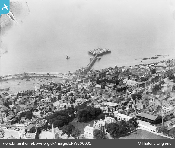
EPW000631 ENGLAND (1920). The Jetty, Margate, from the south-east, 1920
© Copyright OpenStreetMap contributors and licensed by the OpenStreetMap Foundation. 2024. Cartography is licensed as CC BY-SA.
Nearby Images (25)
EPW000631

EPW018599

EPW048847

EPW000627

EPW000625

EPW048846

EAW015840

EAW015841

EPW048684

EPW048689

EPW048692

EPW018607

EPW048690

EPW048688

EPW035467

EPW048685

EPW048845

EPW000162

EPW048691

EPW000619

EPW000633

EPW048687

EPW048851

EPW048686

EPW048850

Details
| Title | [EPW000631] The Jetty, Margate, from the south-east, 1920 |
| Reference | EPW000631 |
| Date | April-1920 |
| Link | |
| Place name | MARGATE |
| Parish | |
| District | |
| Country | ENGLAND |
| Easting / Northing | 635346, 171271 |
| Longitude / Latitude | 1.3832332728038, 51.391090815569 |
| National Grid Reference | TR353713 |
Pins
Be the first to add a comment to this image!